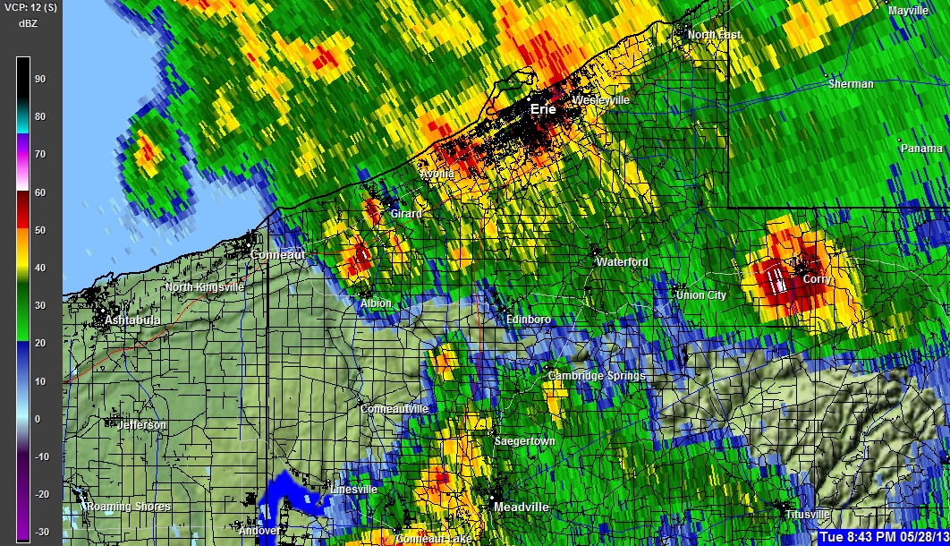
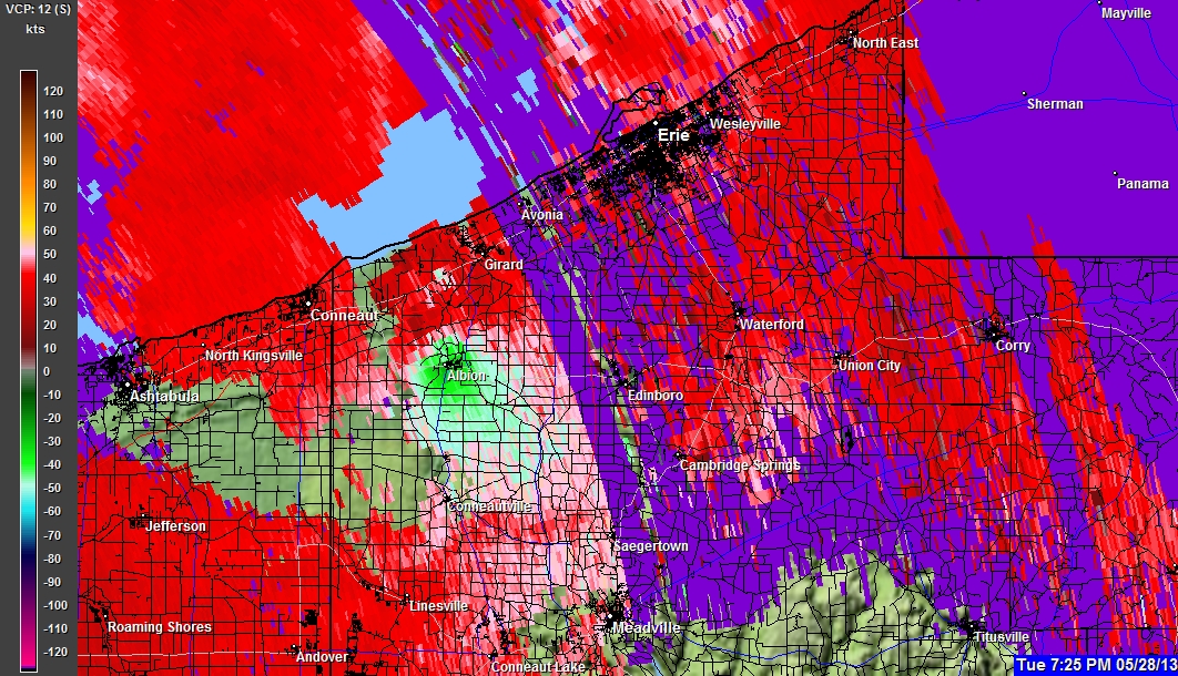
(click on any picture for full resolution)
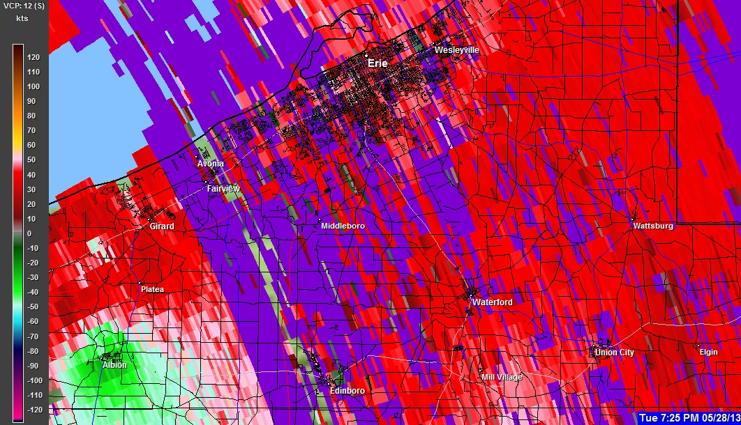
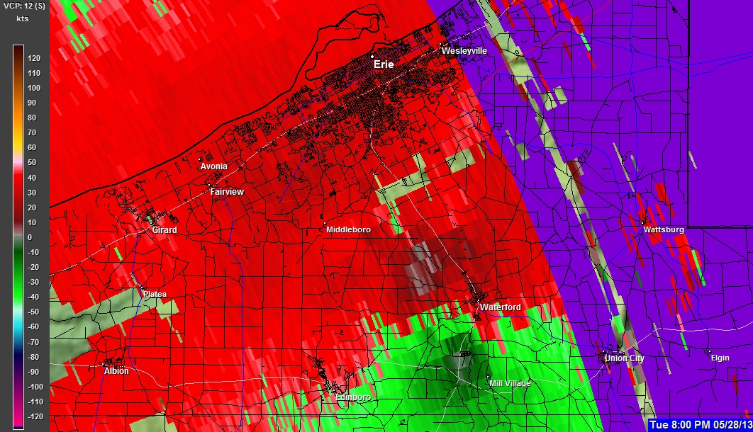
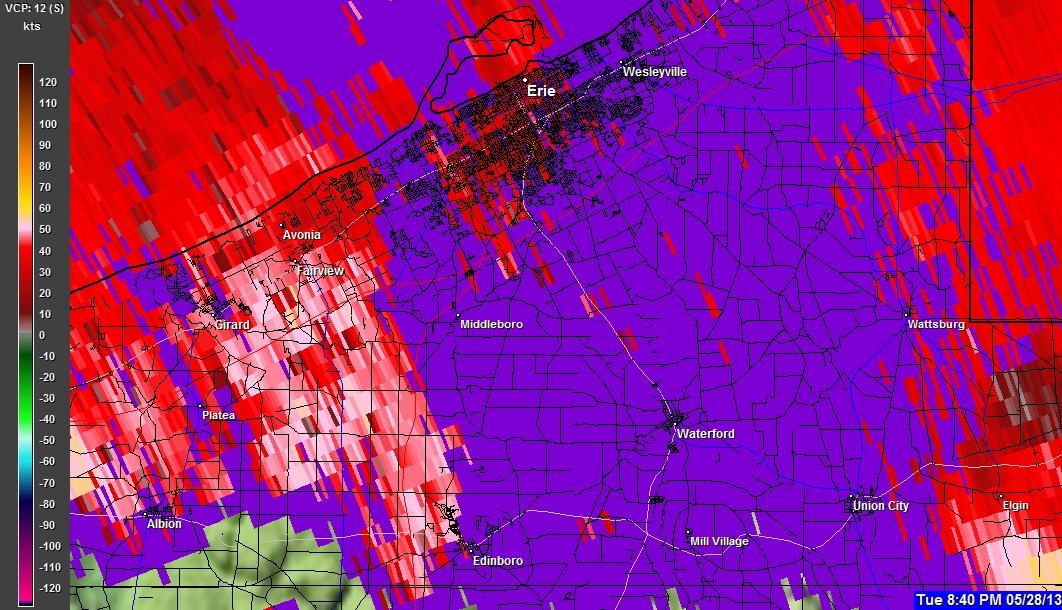
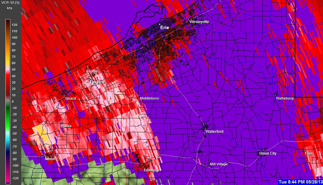
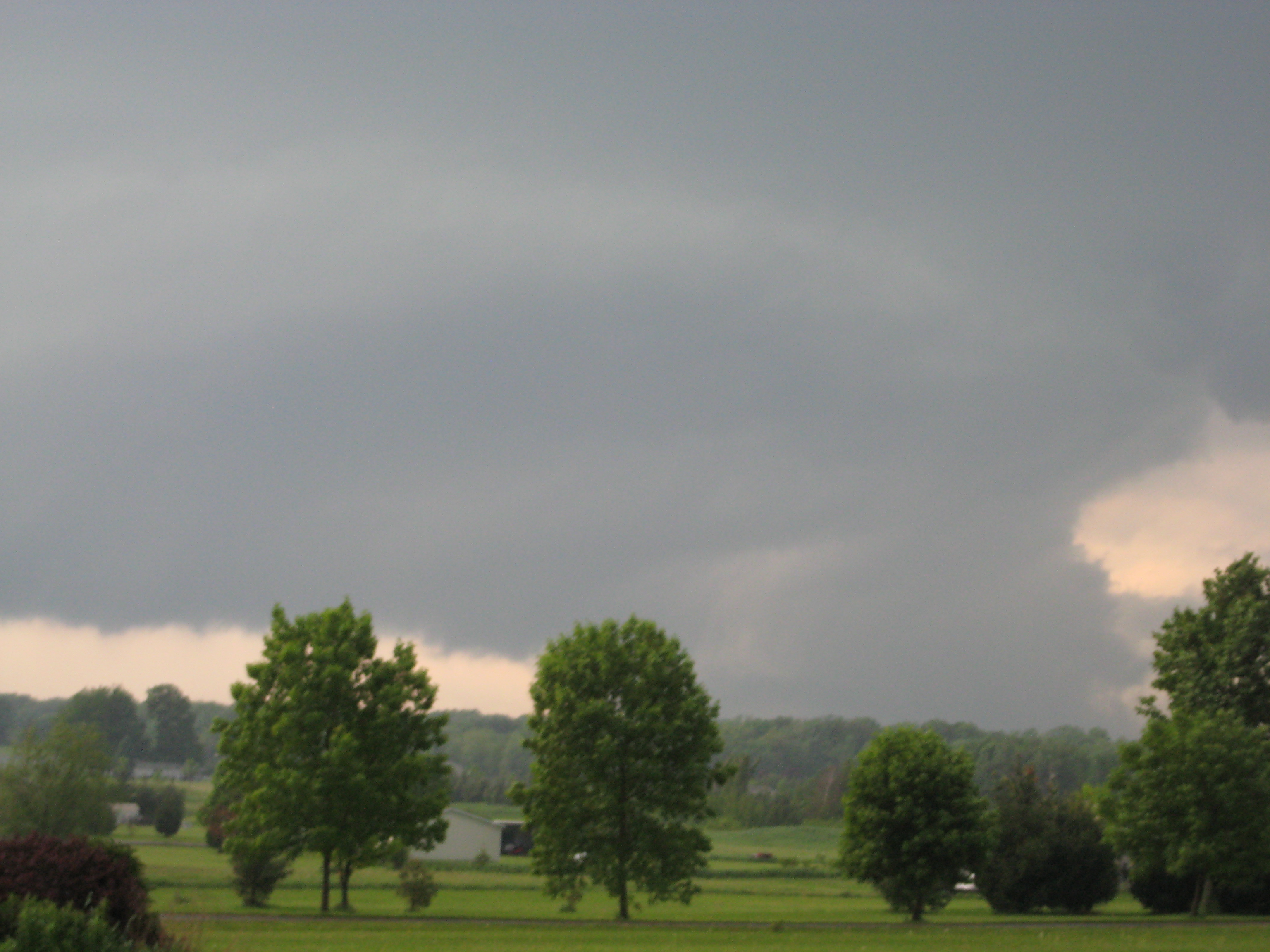
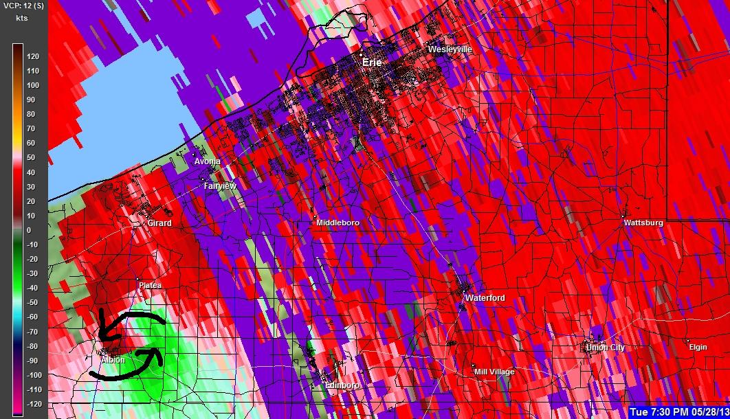
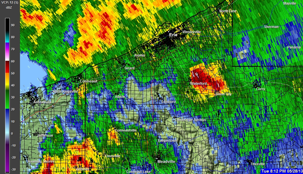
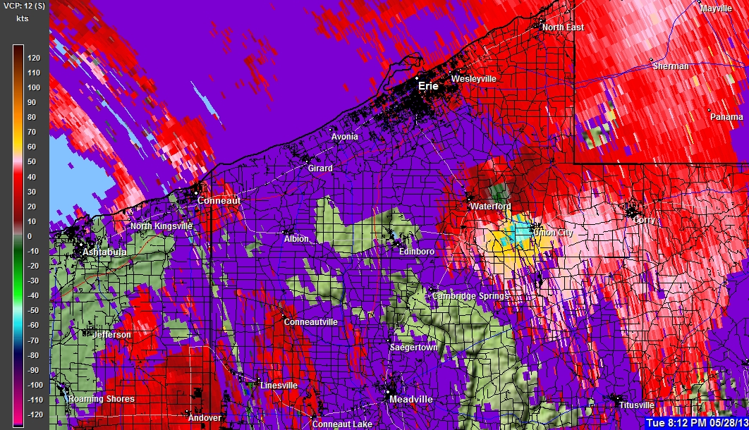
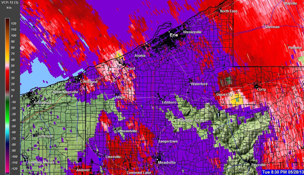
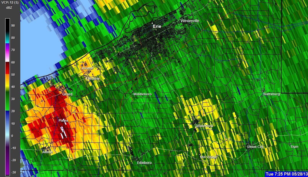
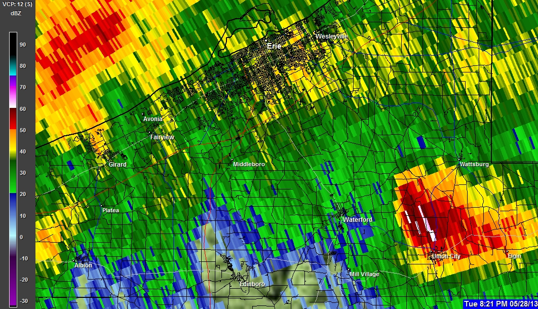
05-28-2013 7:31 PM
05-28-2013 7:31 PM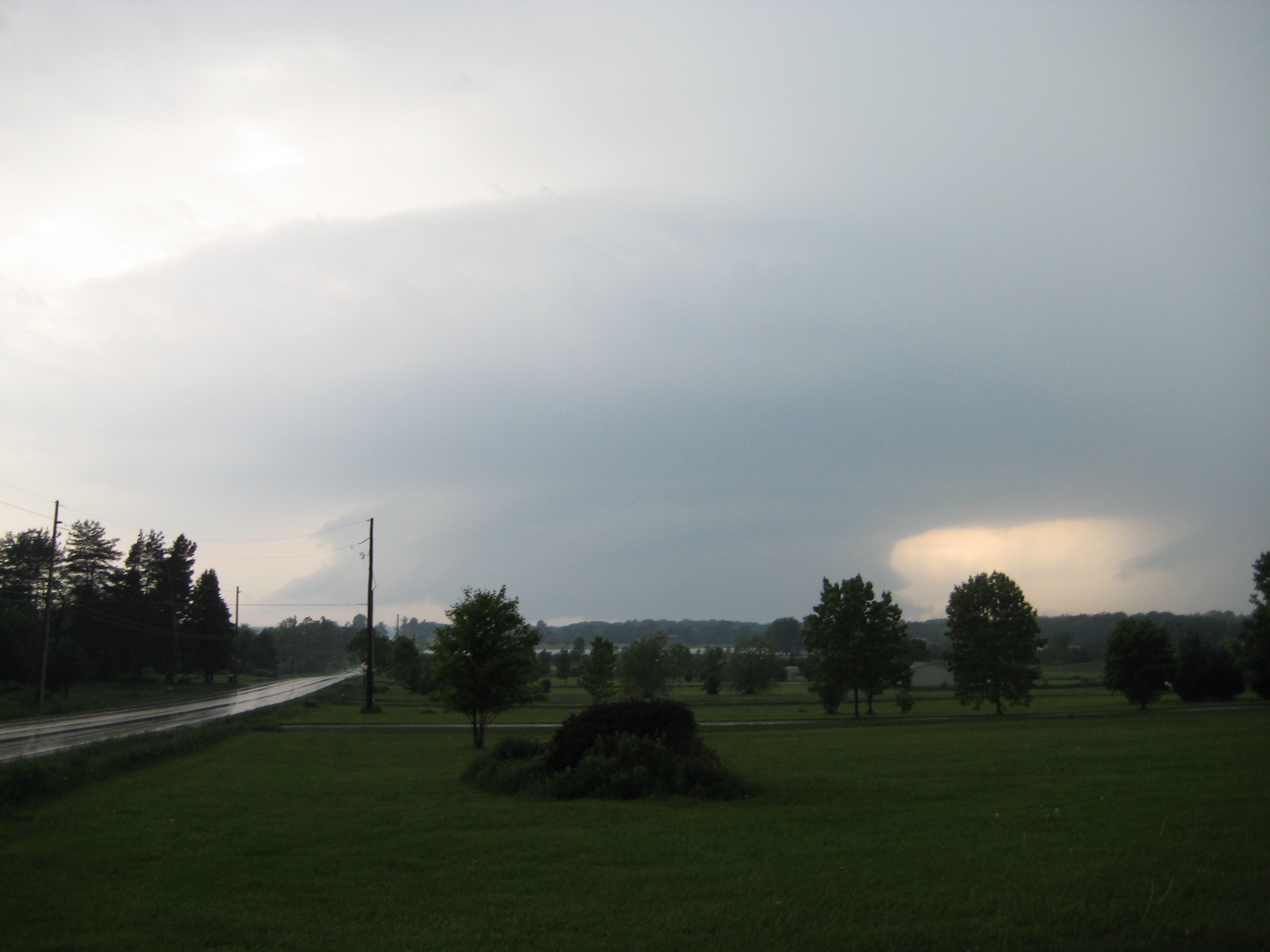
05-28-2013 7:31 PM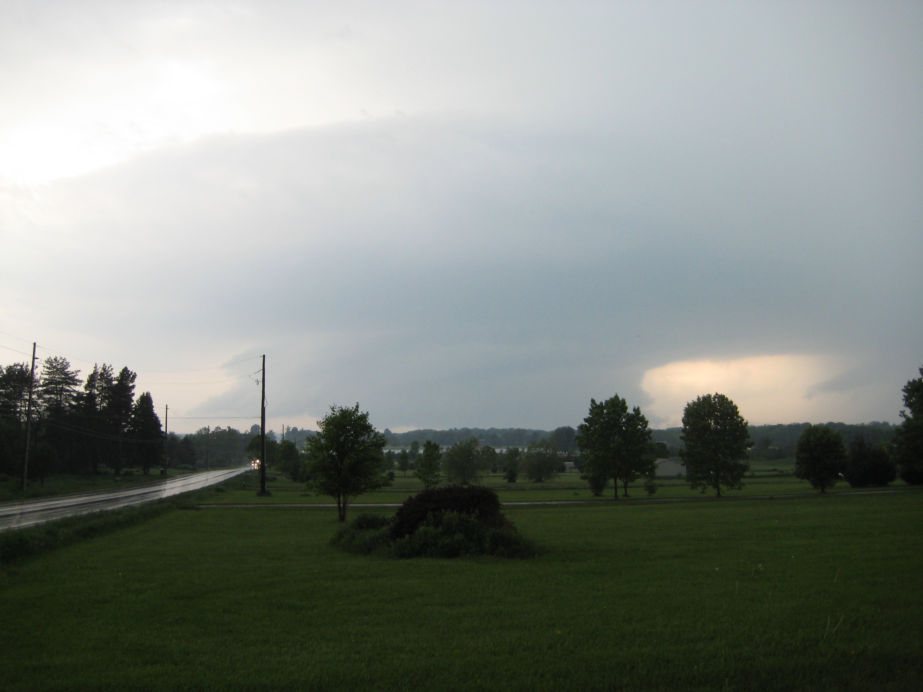
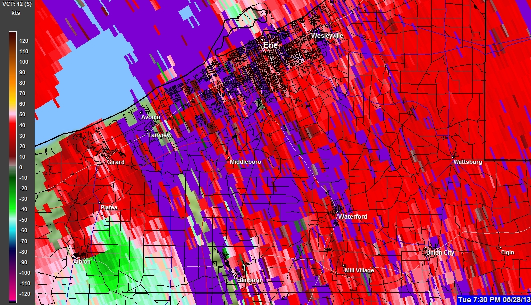
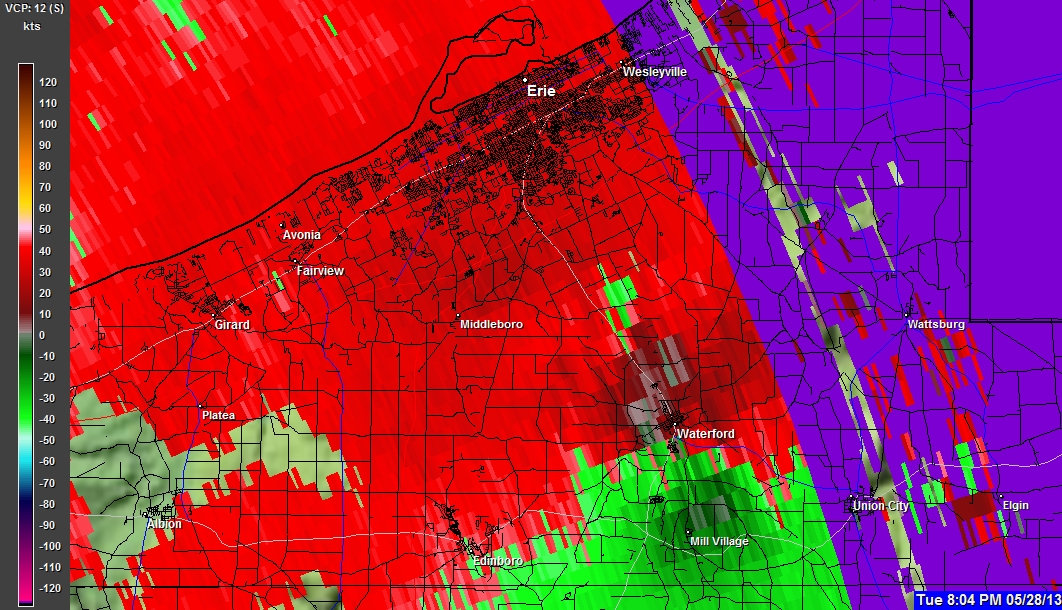
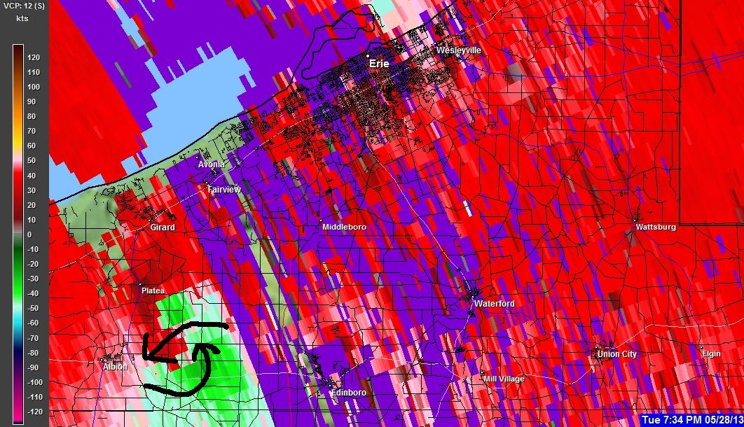
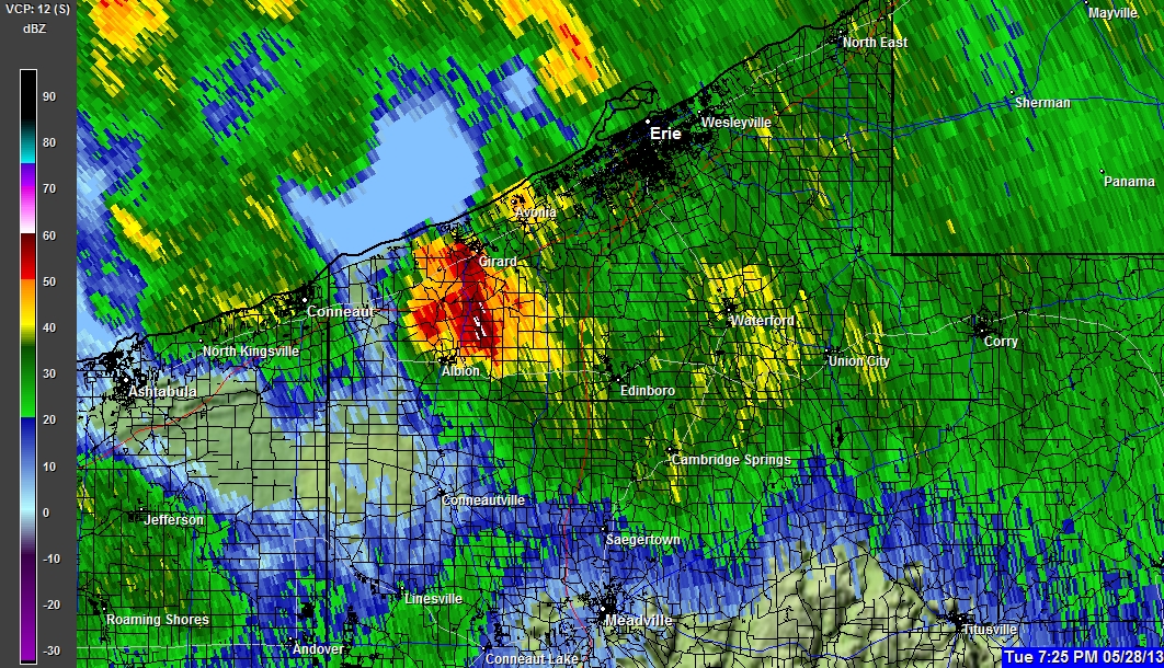
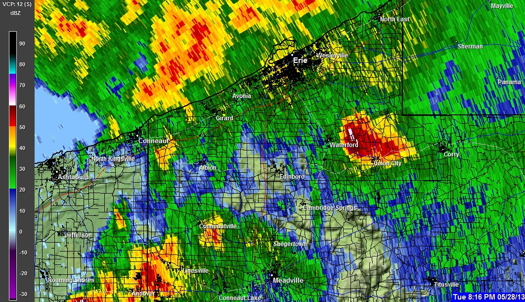
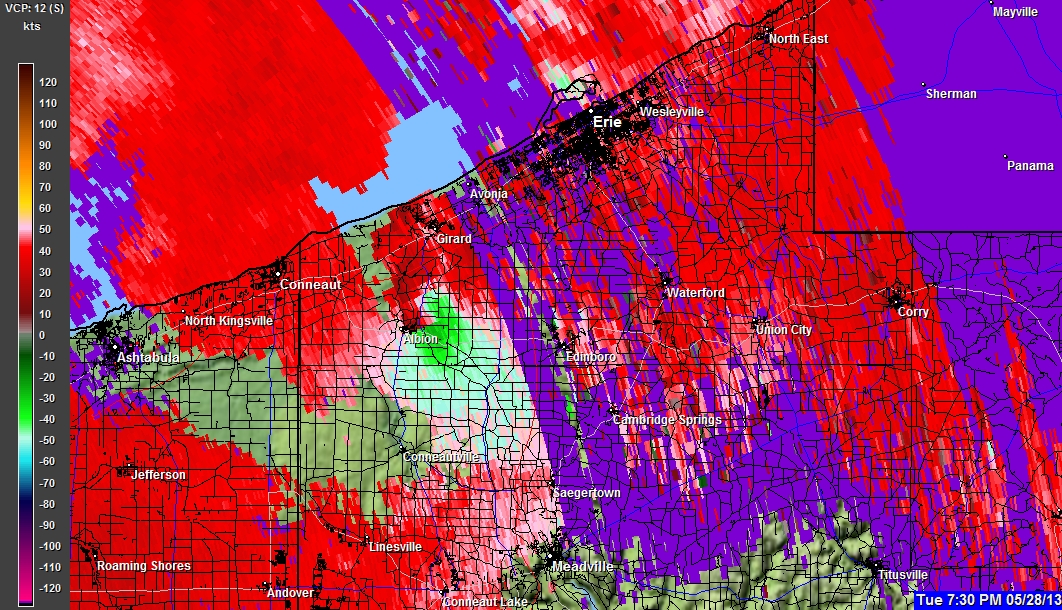
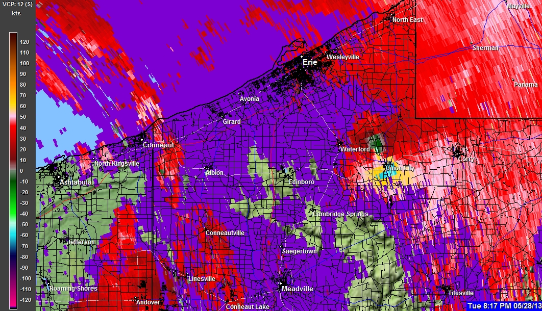
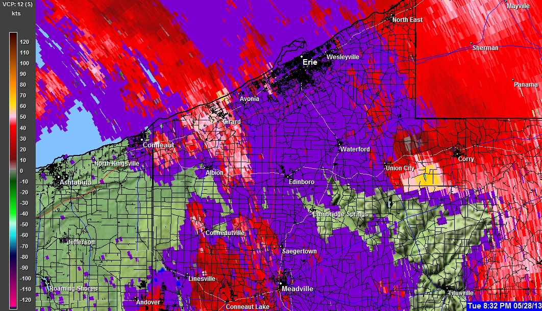
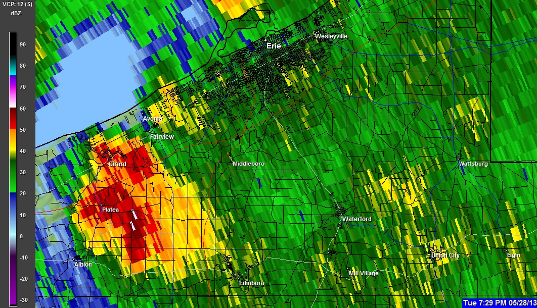
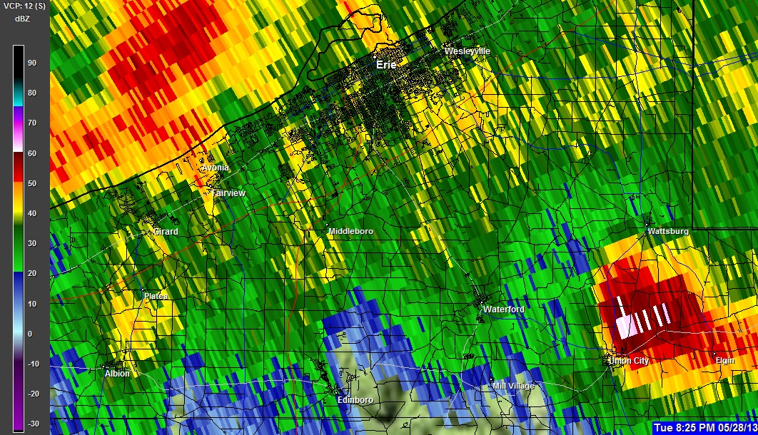
05-28-2013 7:33 PM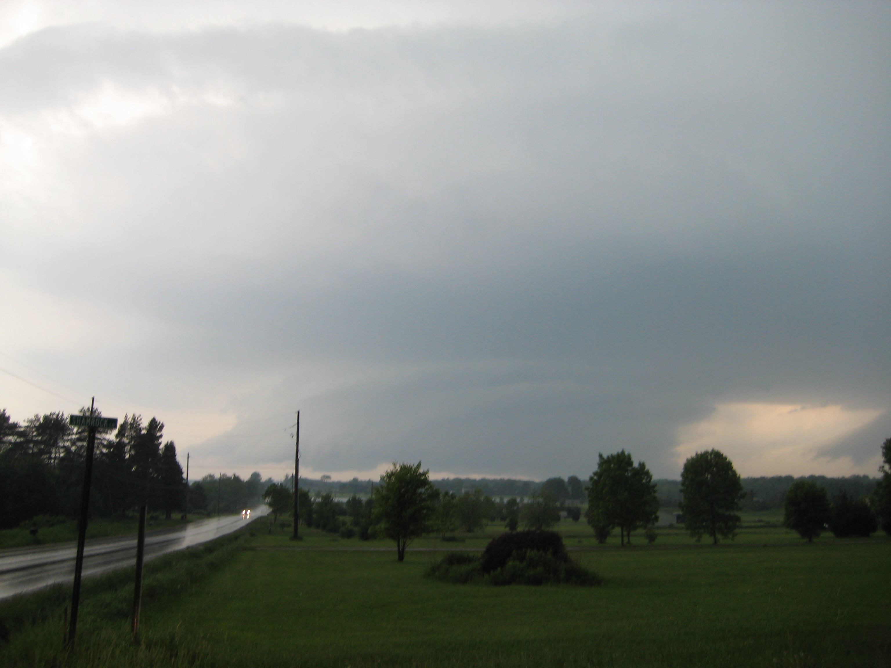
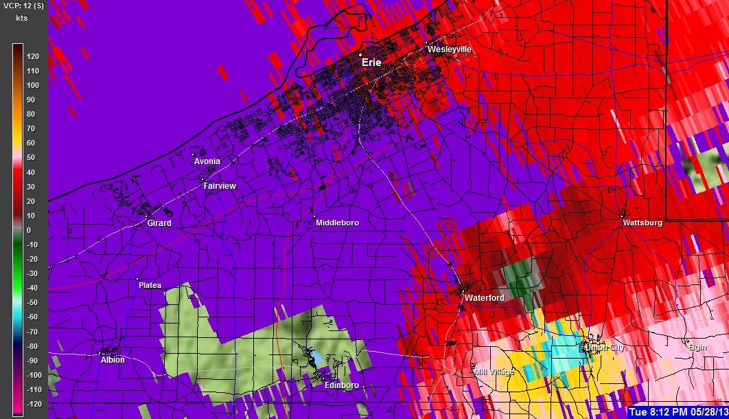
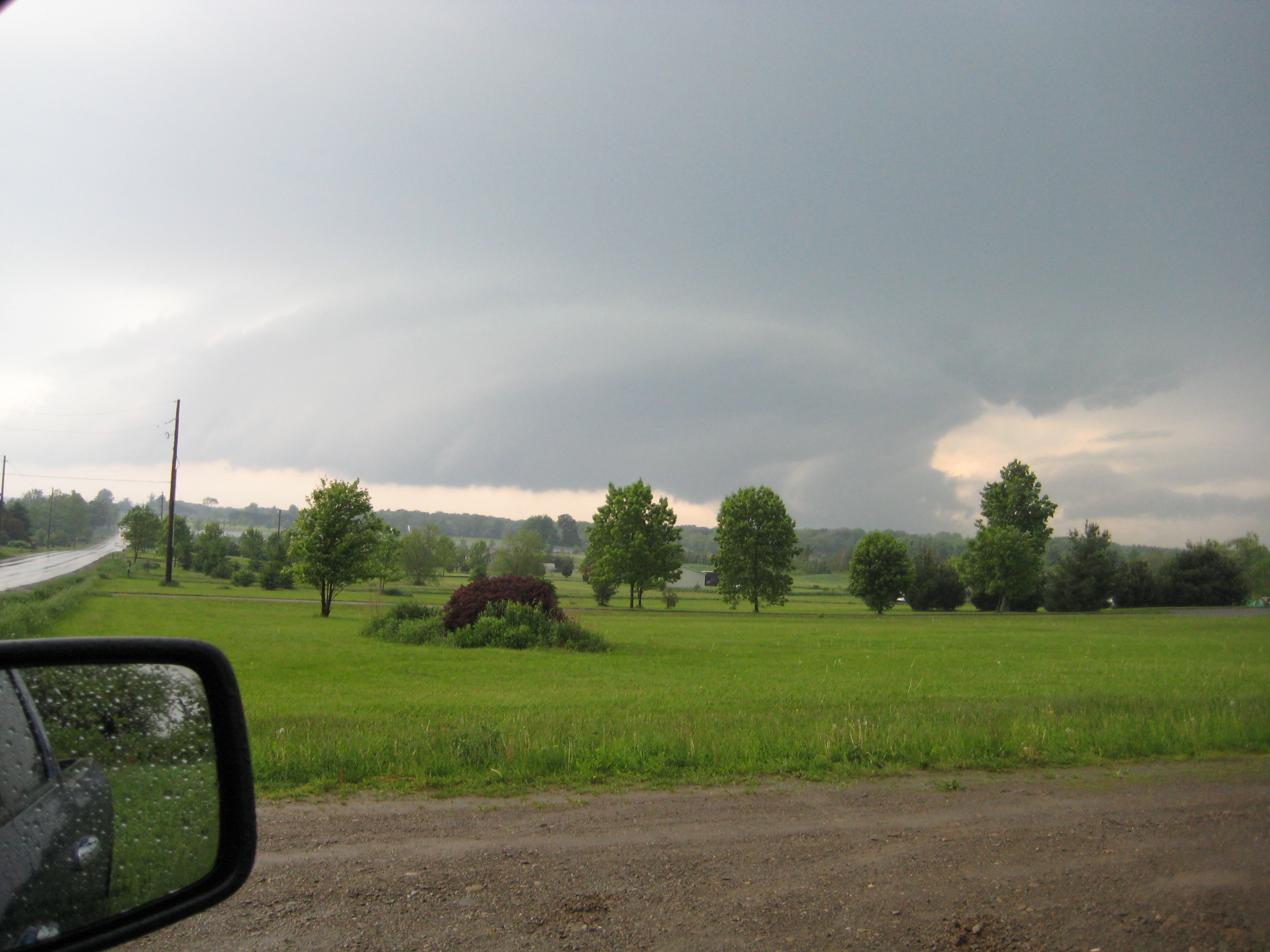
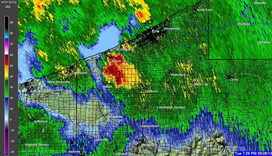
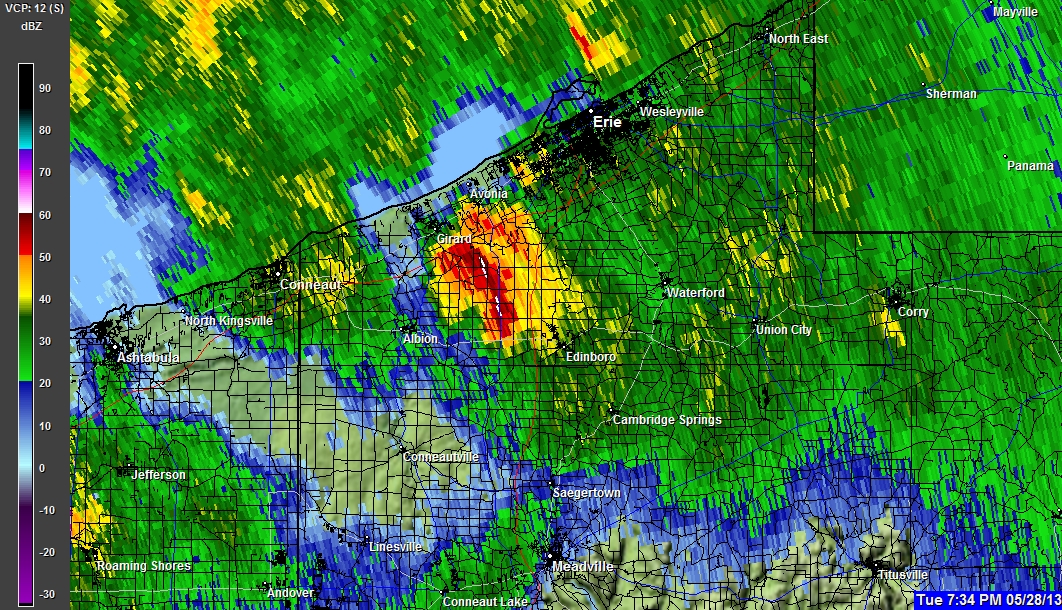
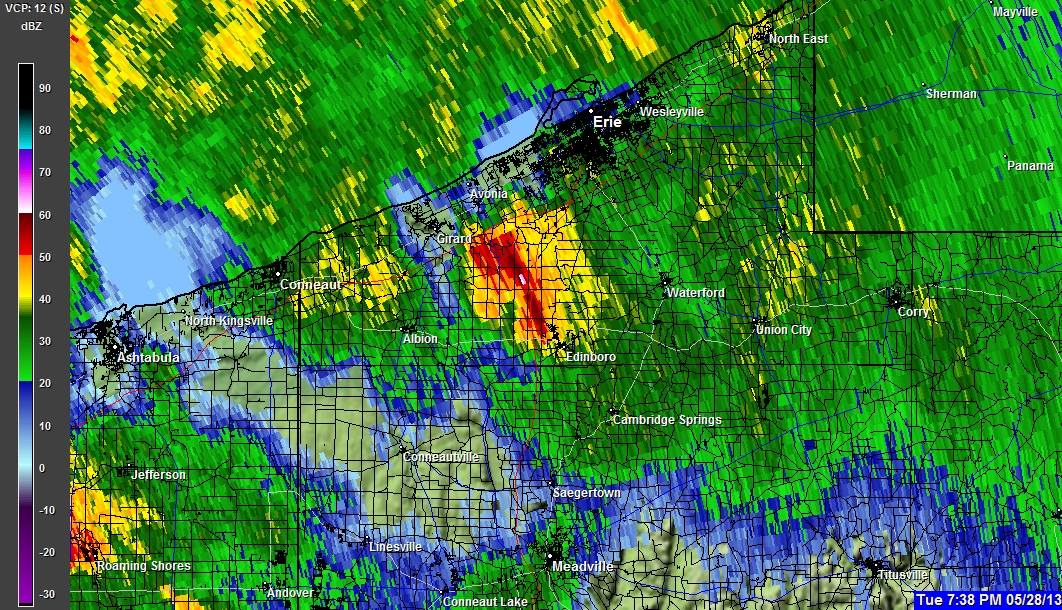
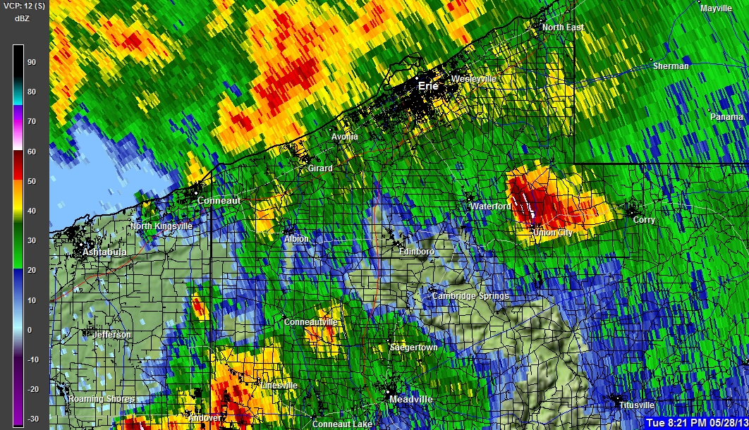
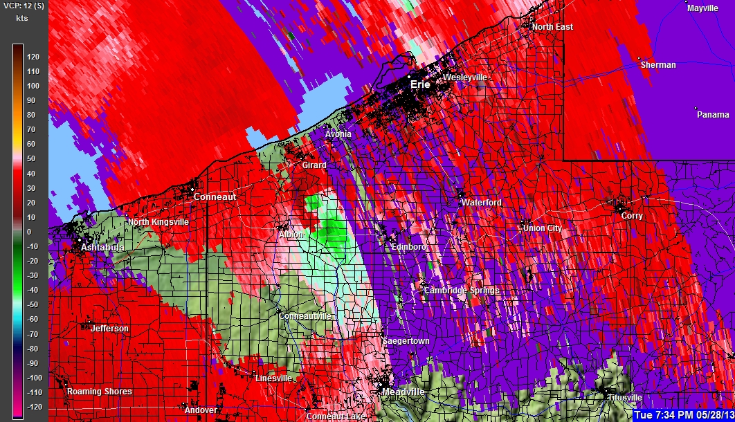
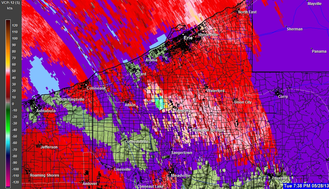
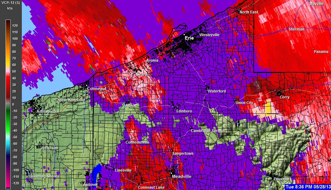
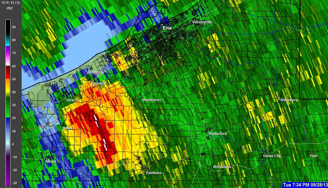
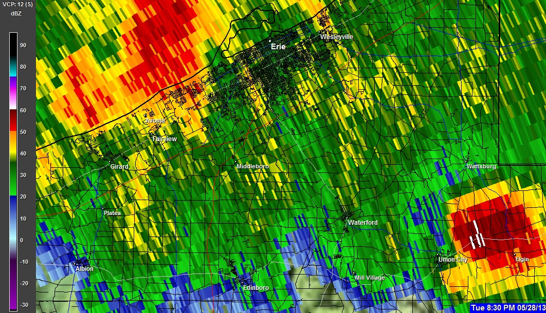
05-28-2013 7:34 PM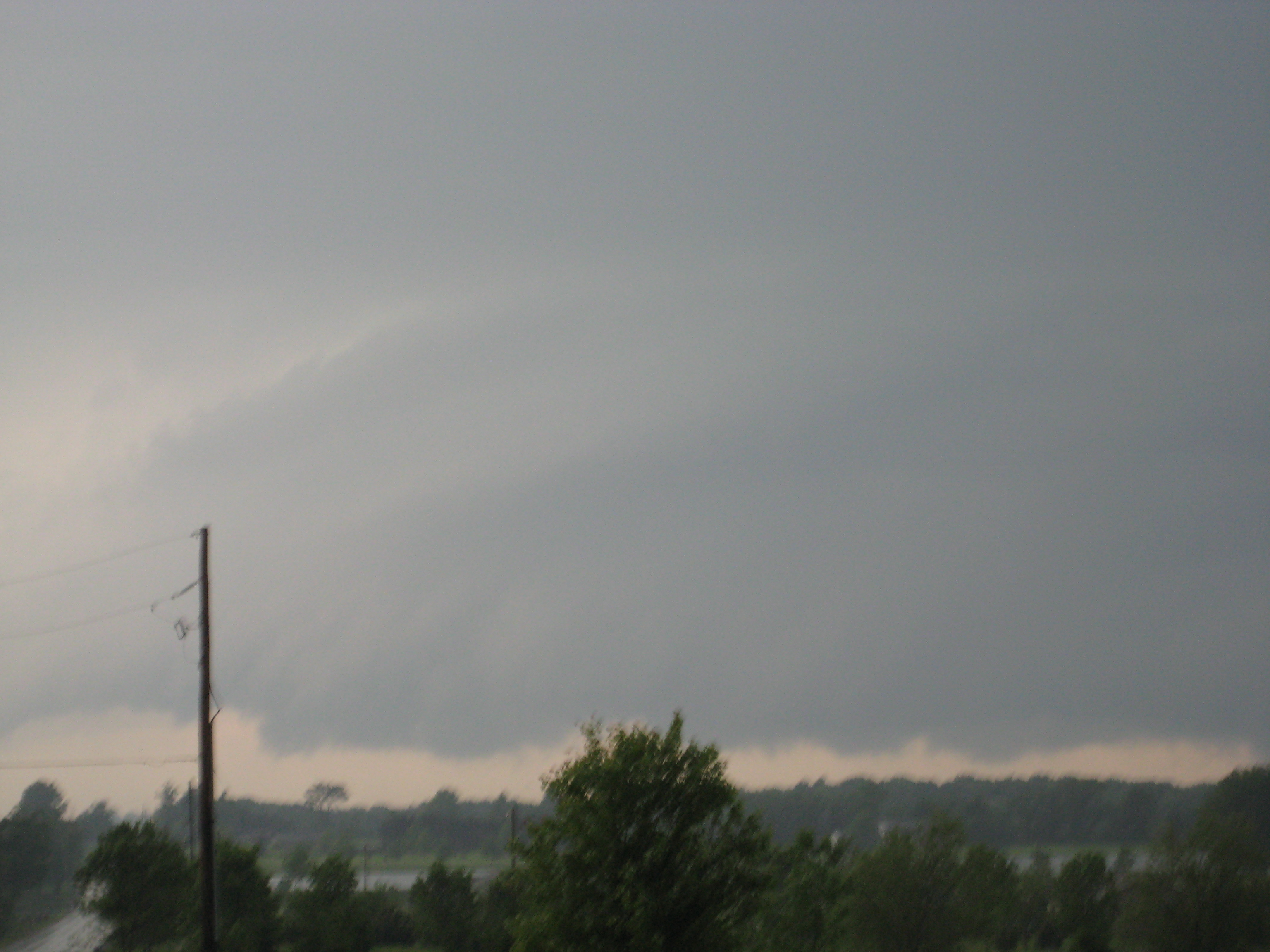
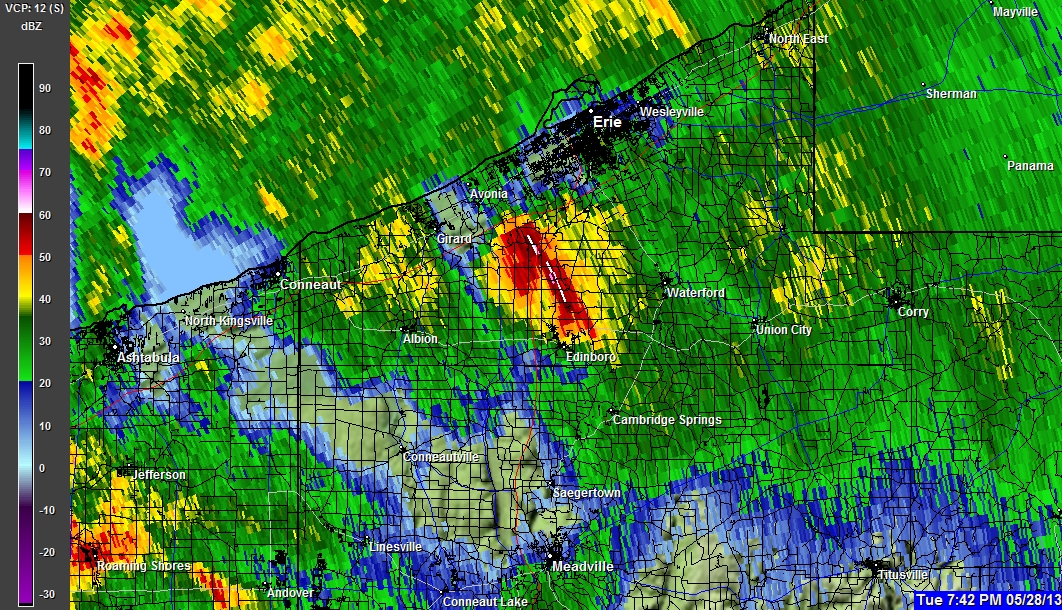
05-28-2013 7:34 PM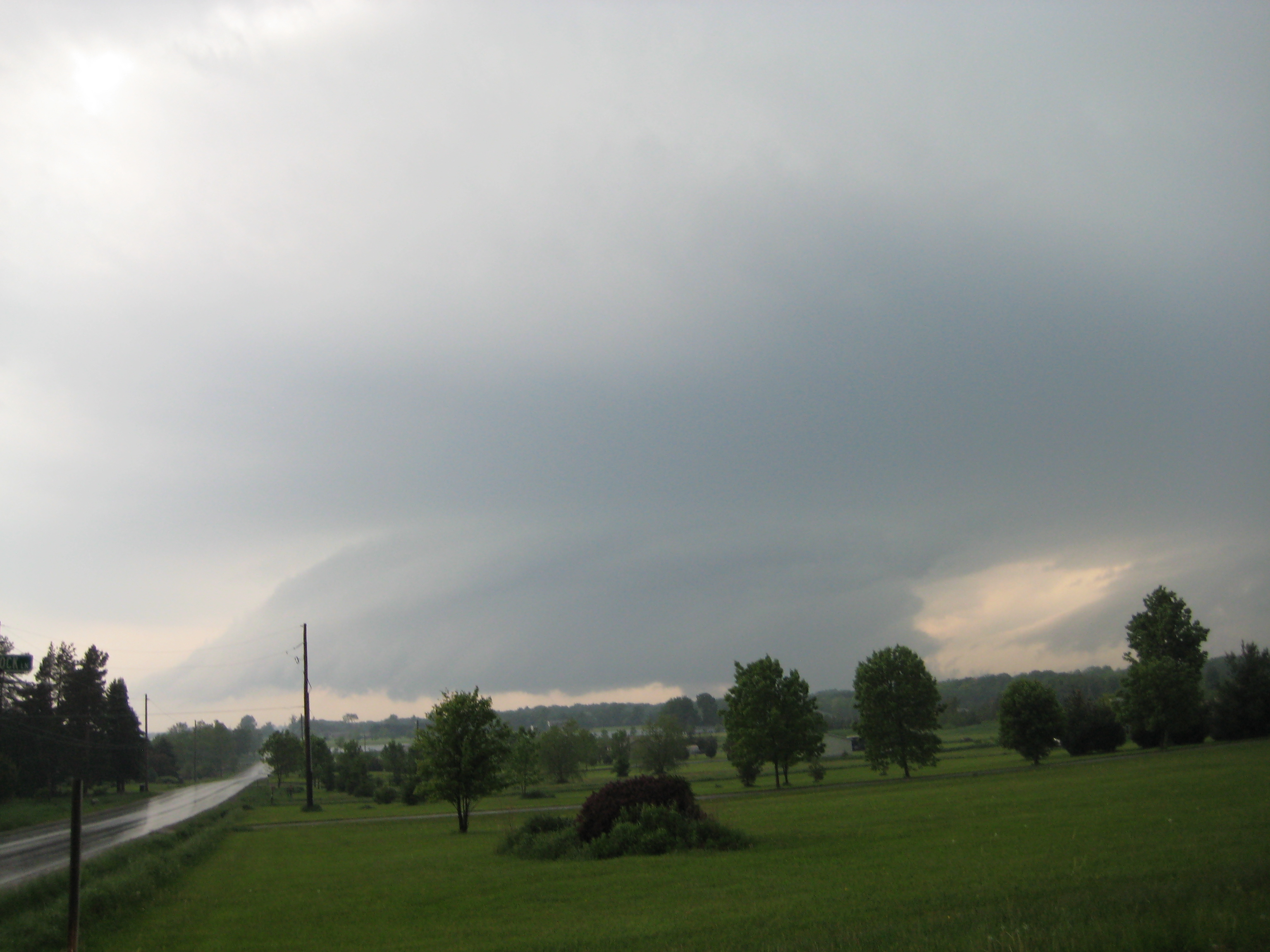
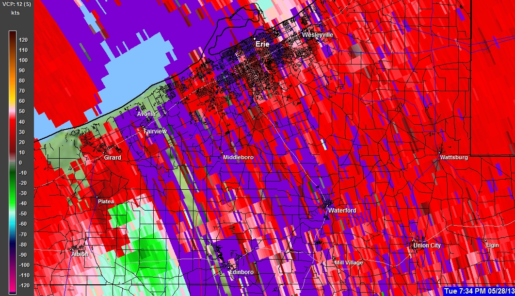
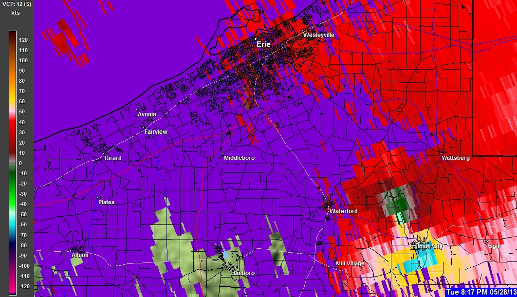
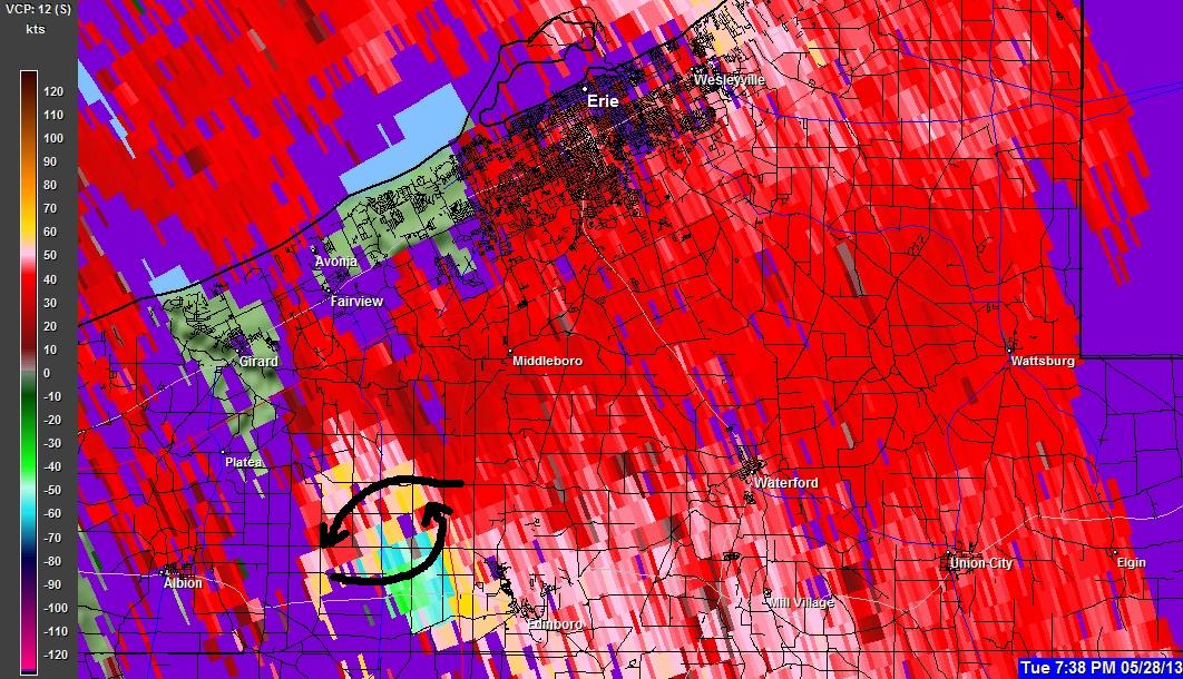
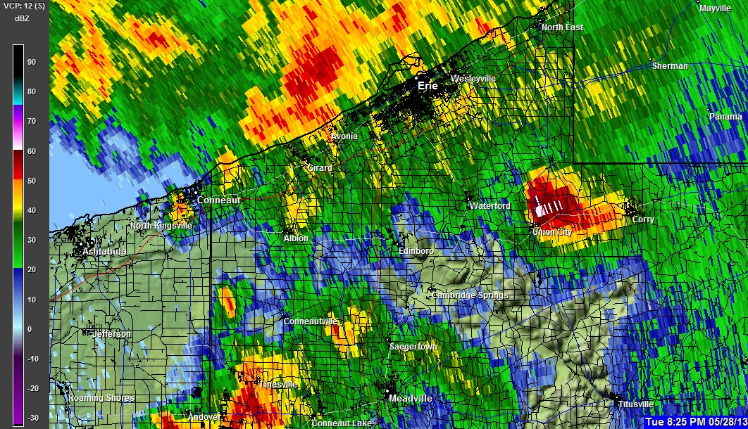
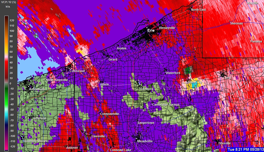
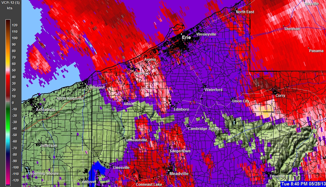
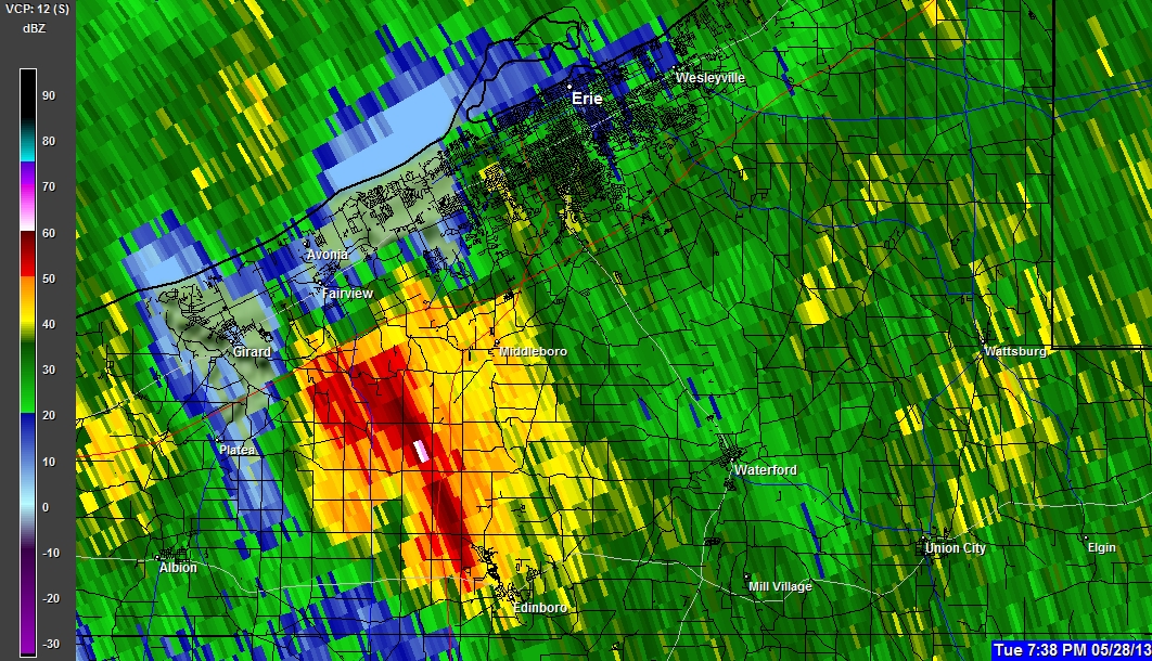
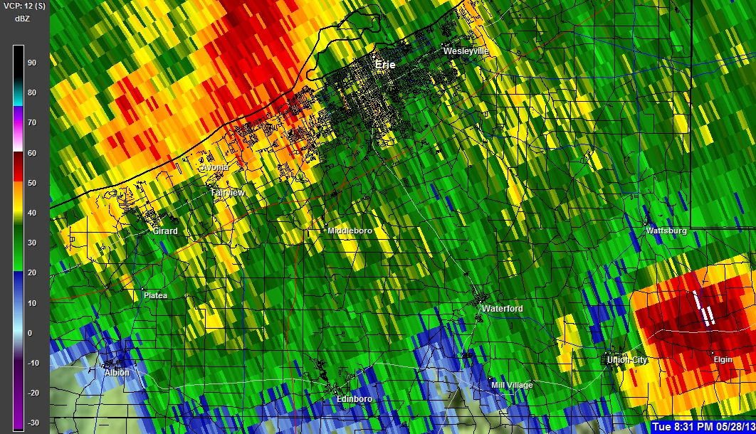
05-28-2013 7:35 PM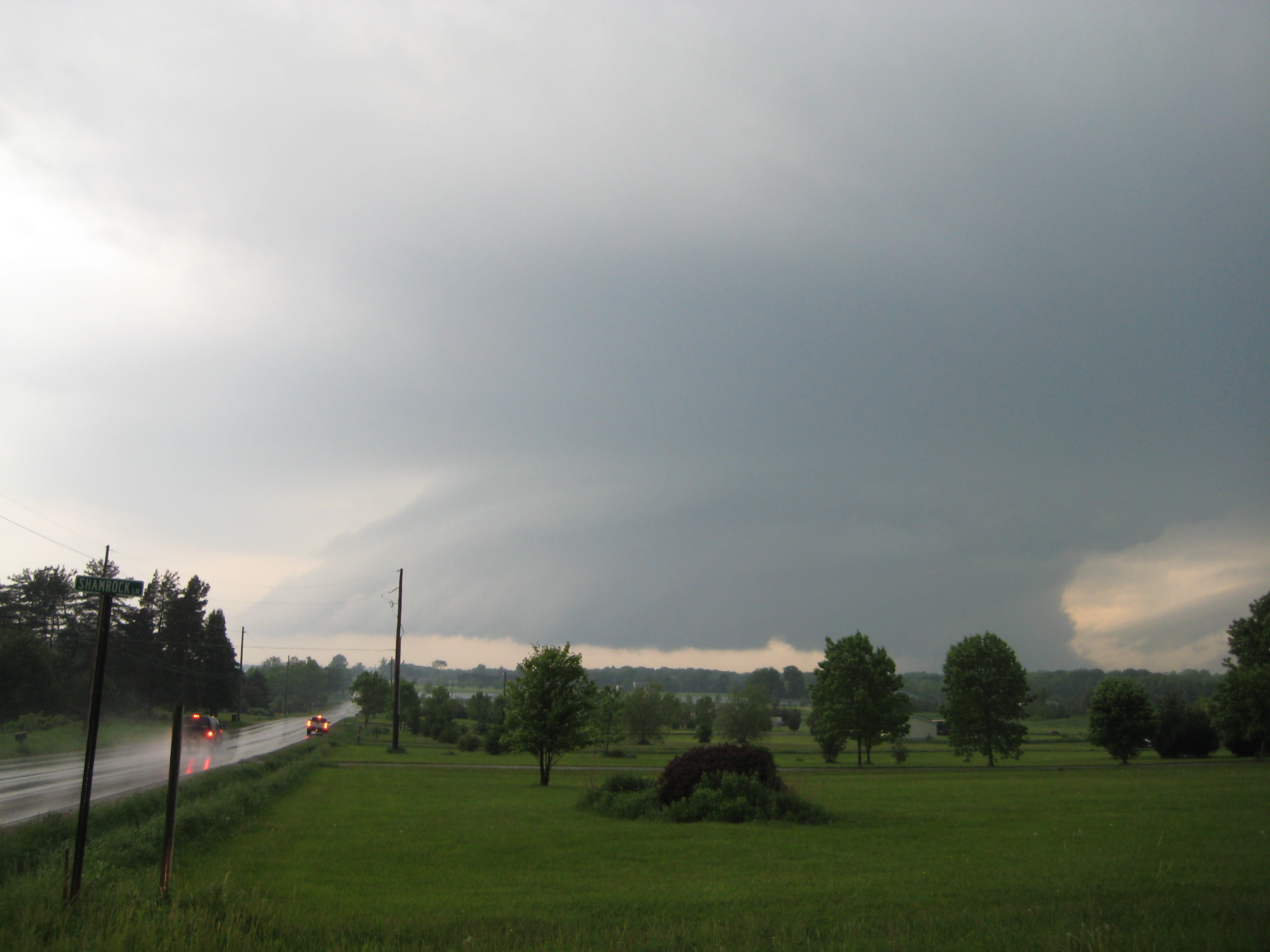
05-28-2013 7:35 PM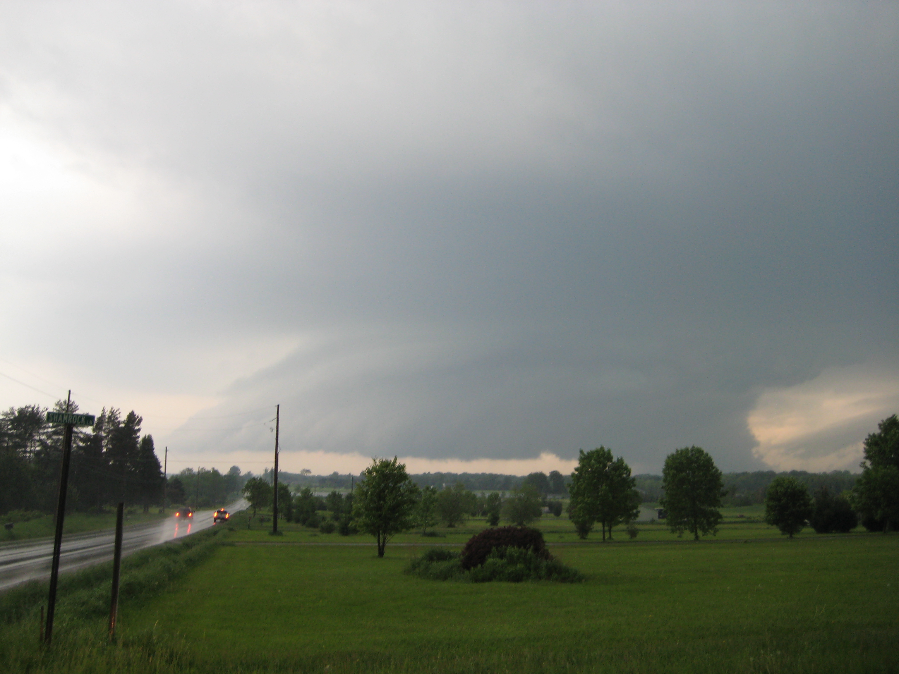
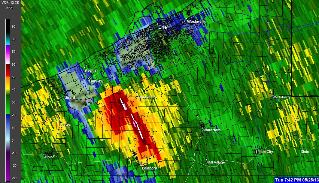
05-28-2013 7:35 PM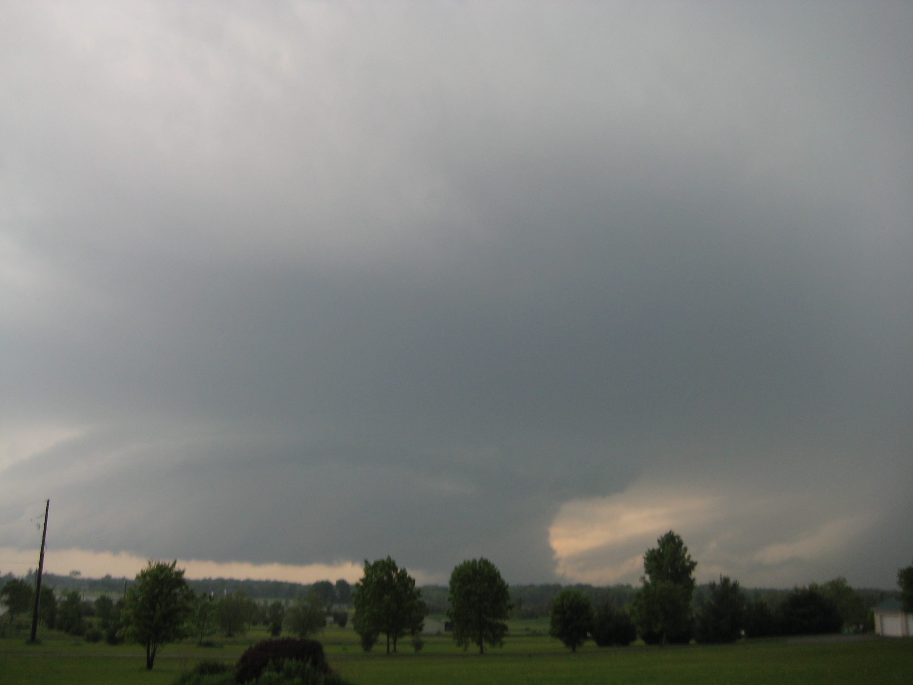
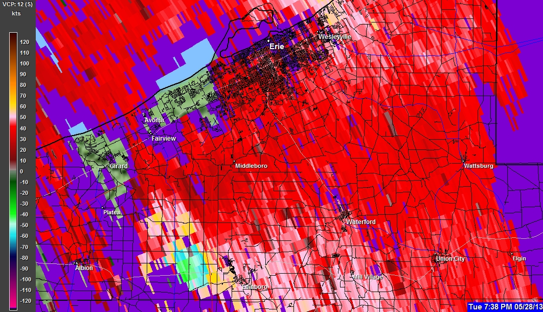
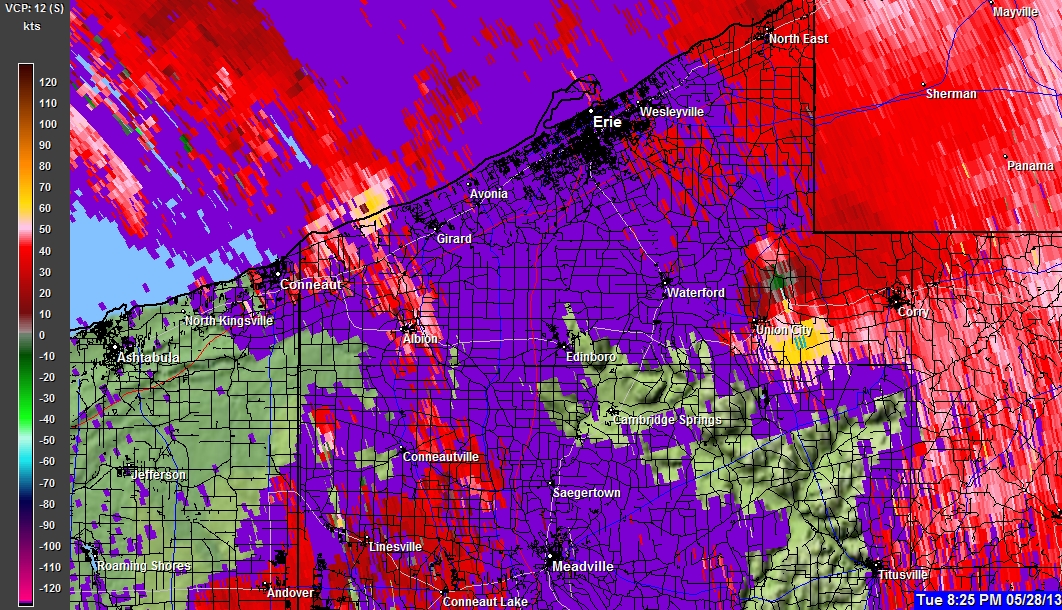
05-28-2013 7:36 PM
05-28-2013 7:36 PM
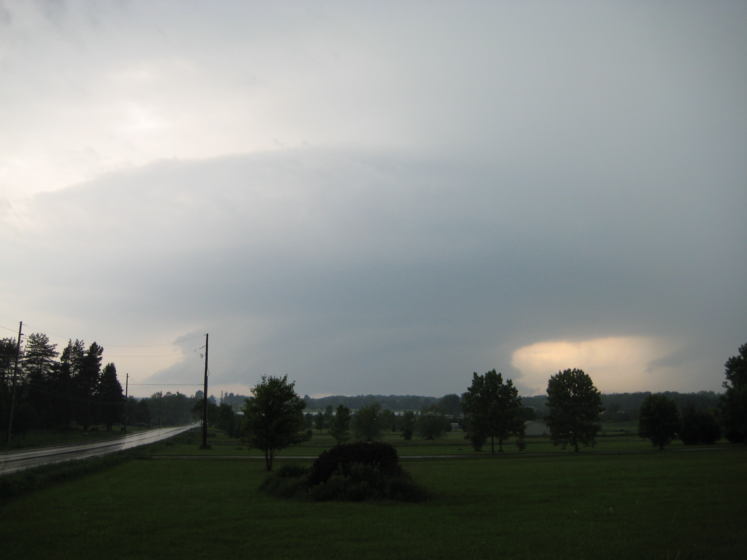
?Pictures taken looking East across I79 from the Edinboro Exit.?
(Pictures of FIRST Tornado Touch down!)
(Transformer explosions occurred approximately 45 seconds after pics)
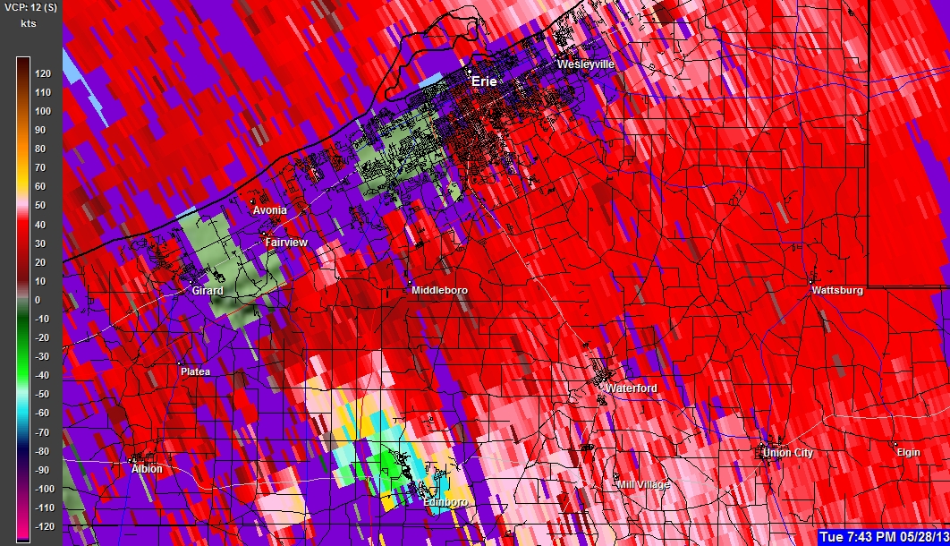
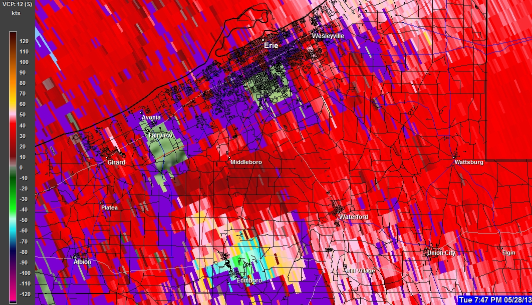
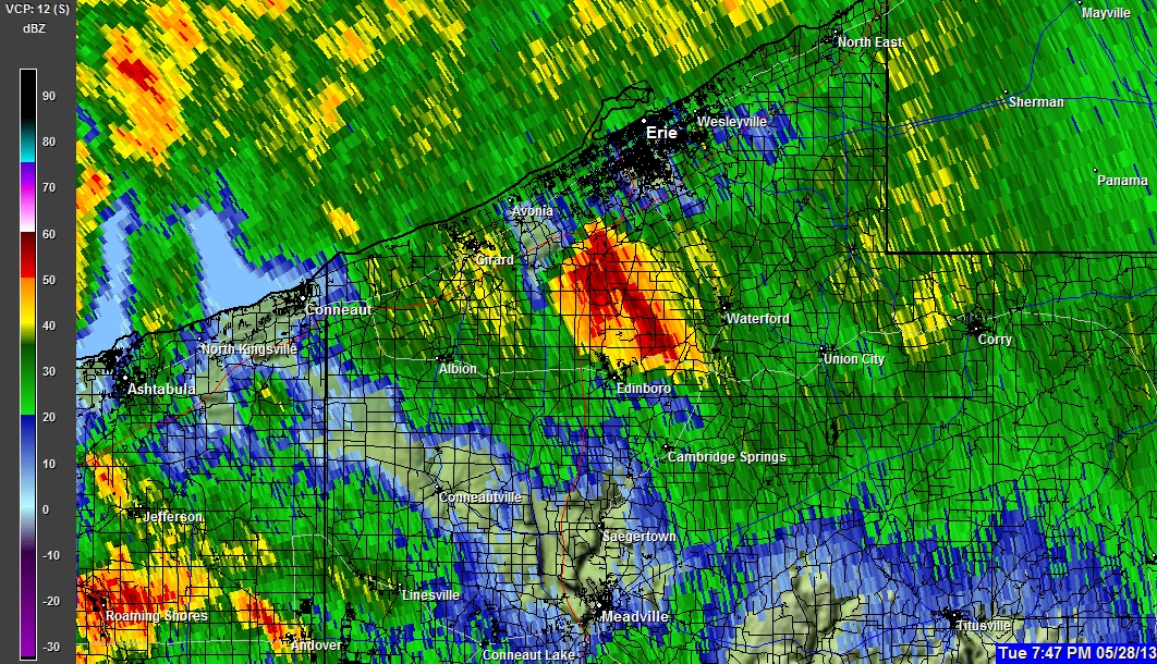
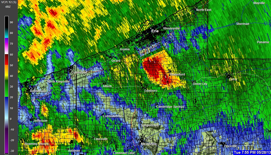
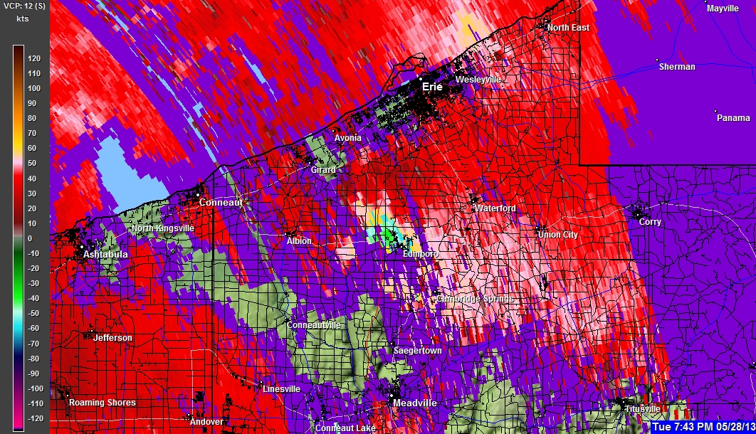
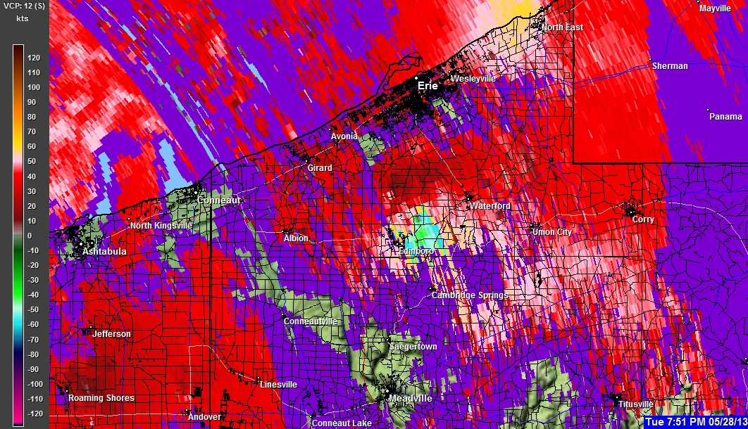
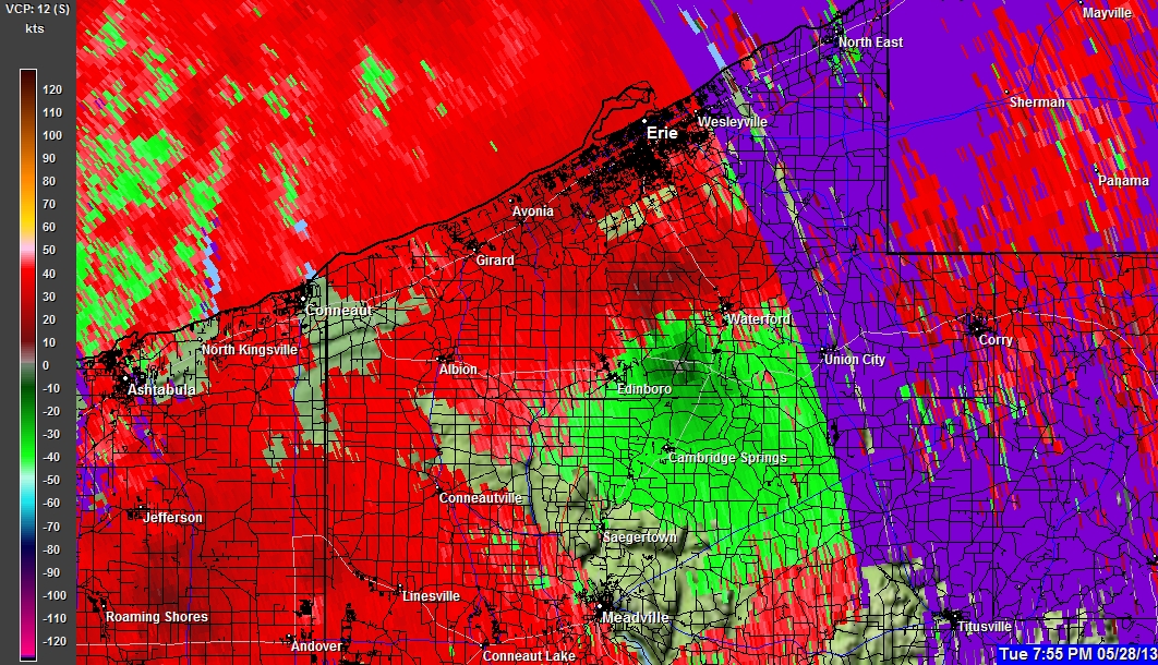
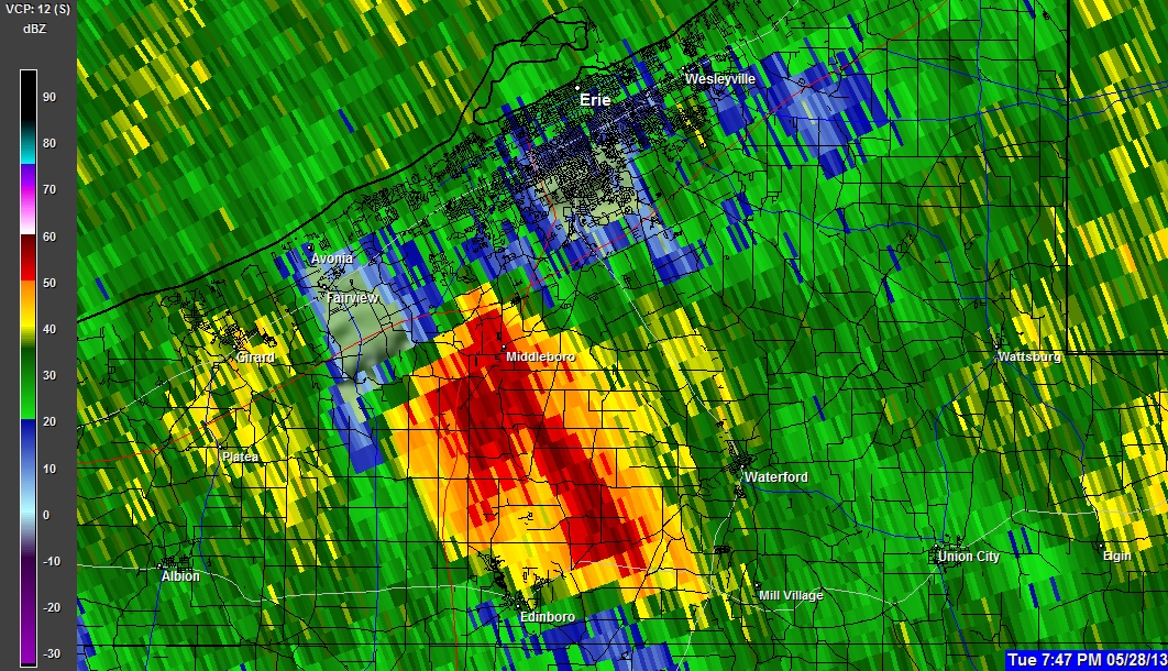
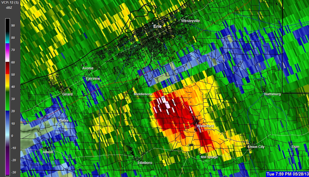
05-28-2013 7:50 PM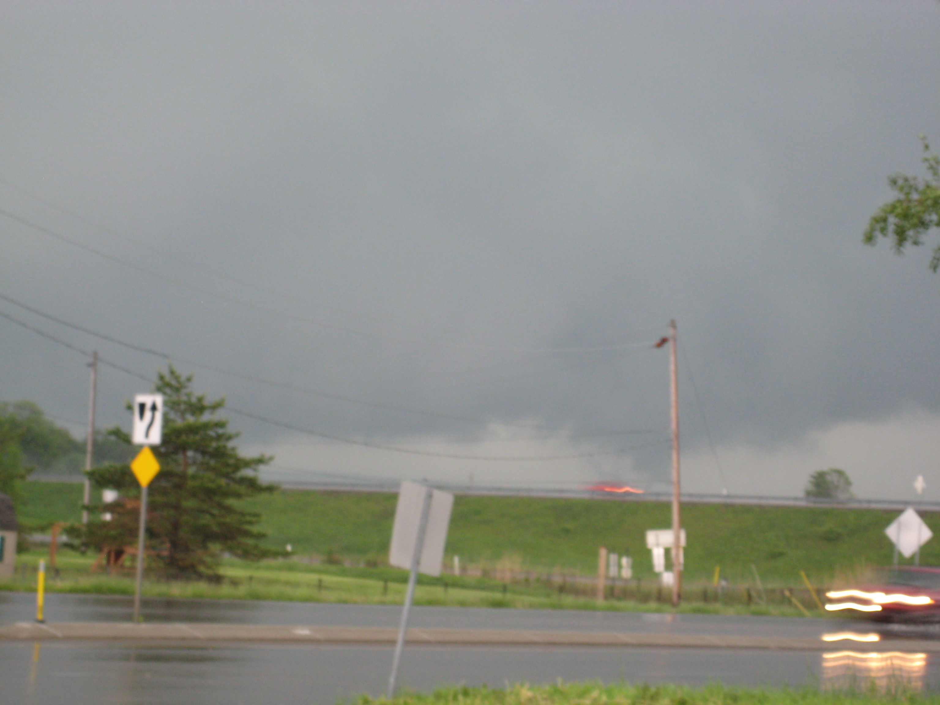
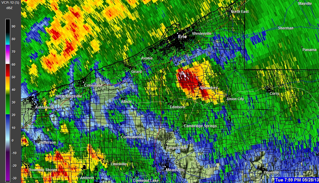
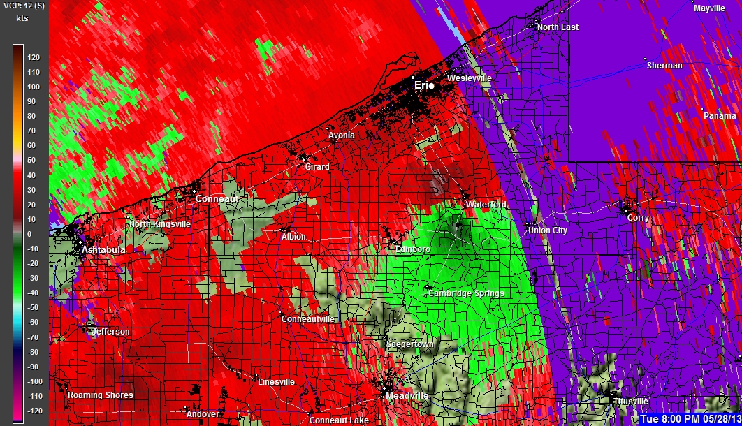
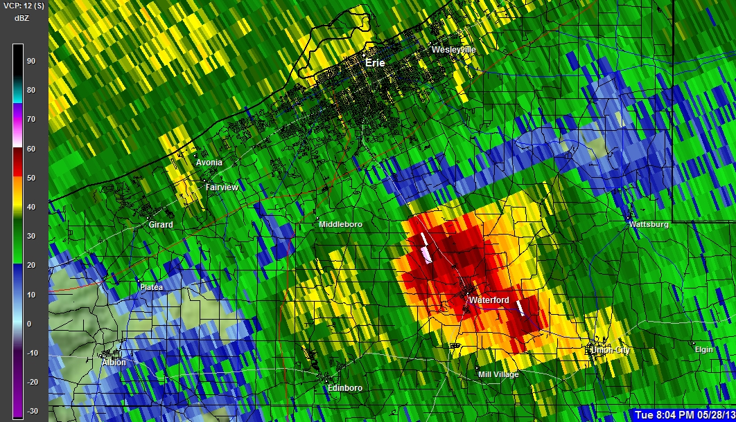
05-28-2013 7:50 PM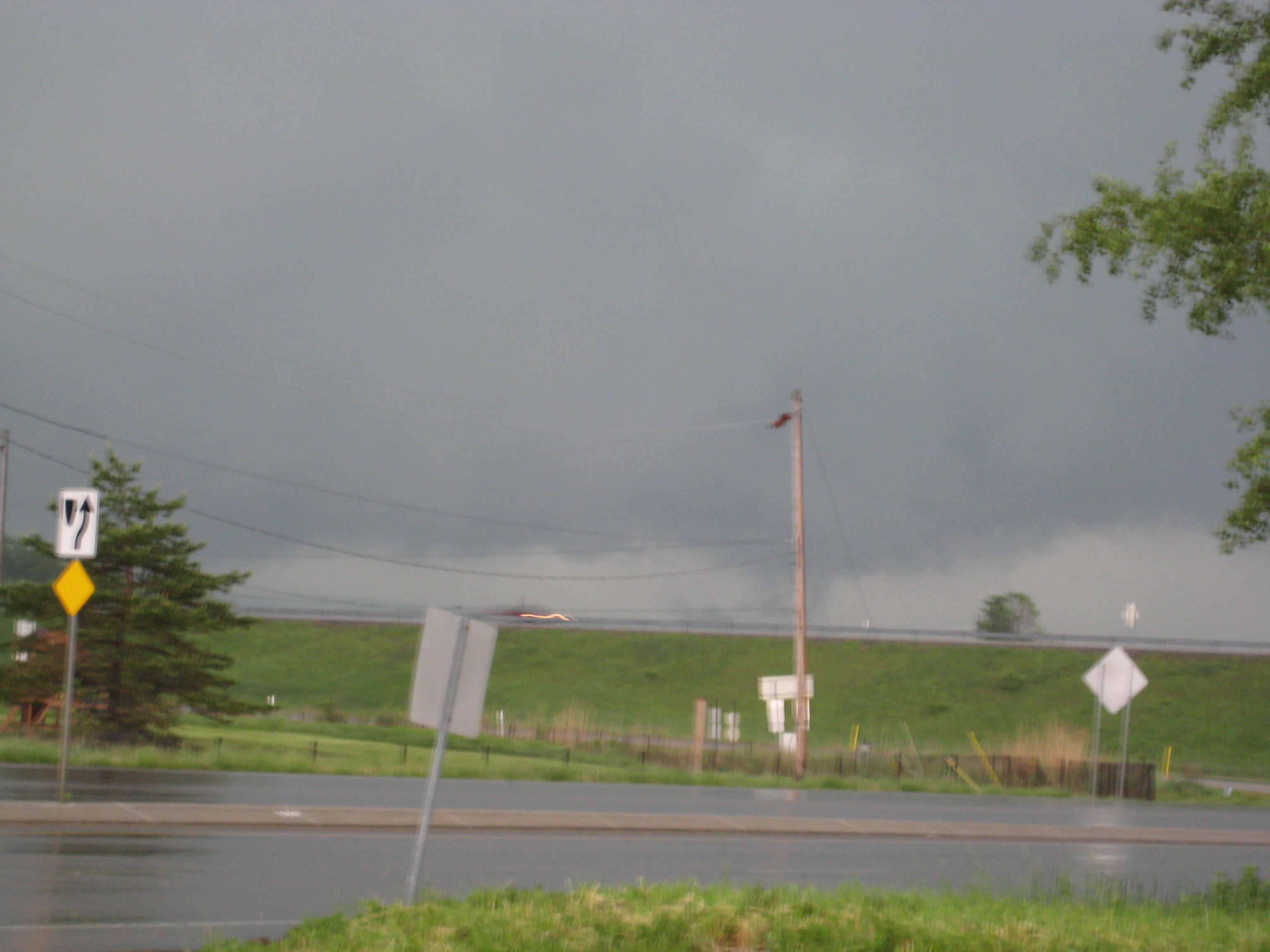
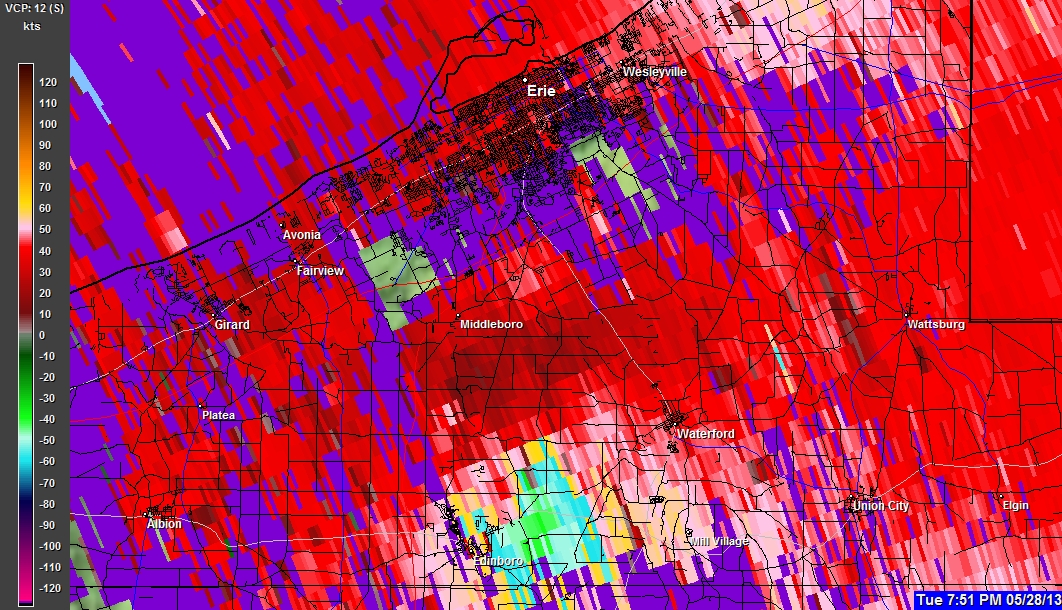
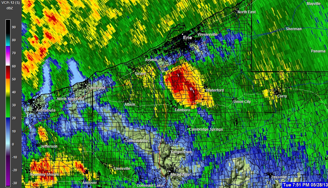
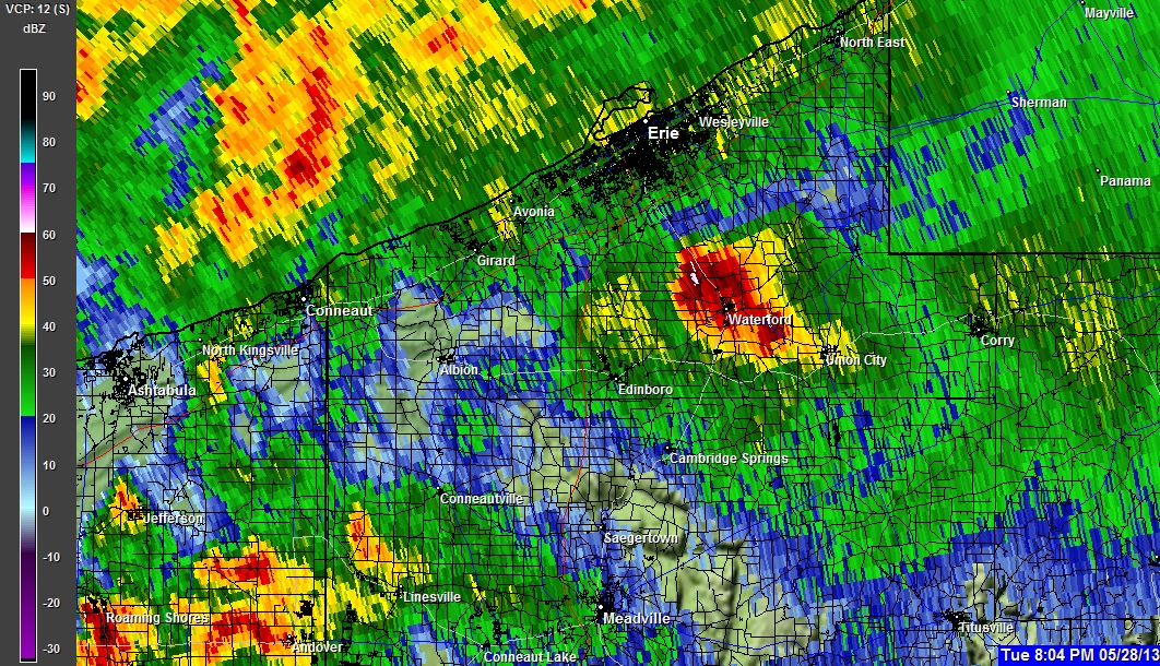
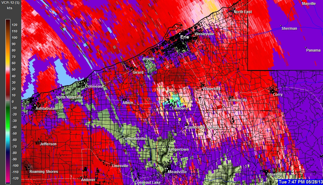
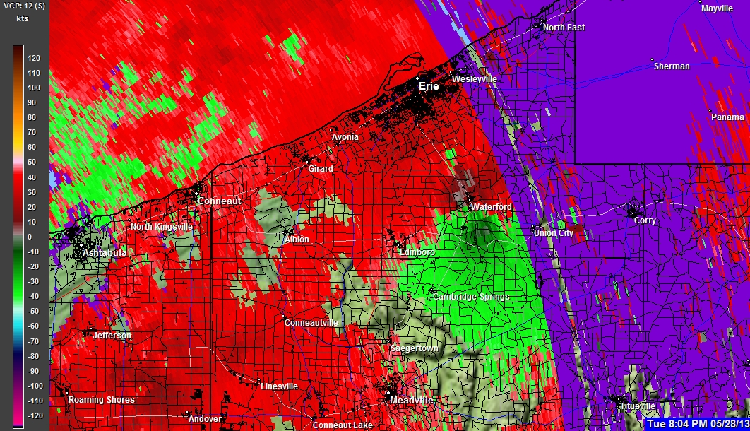
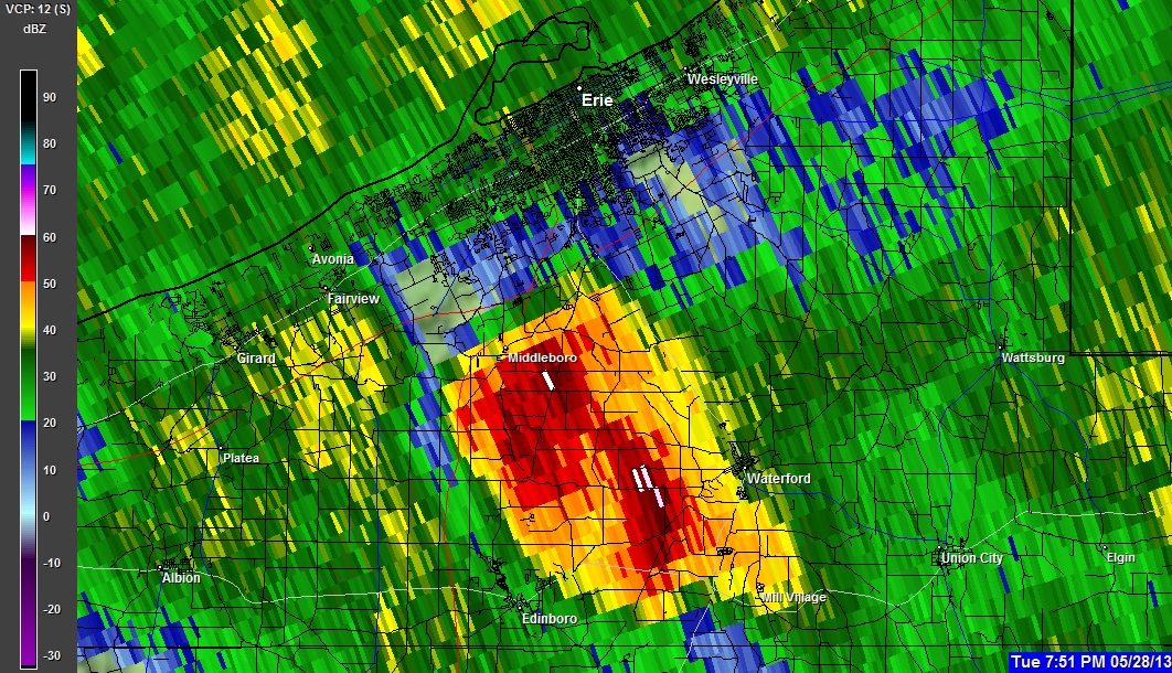
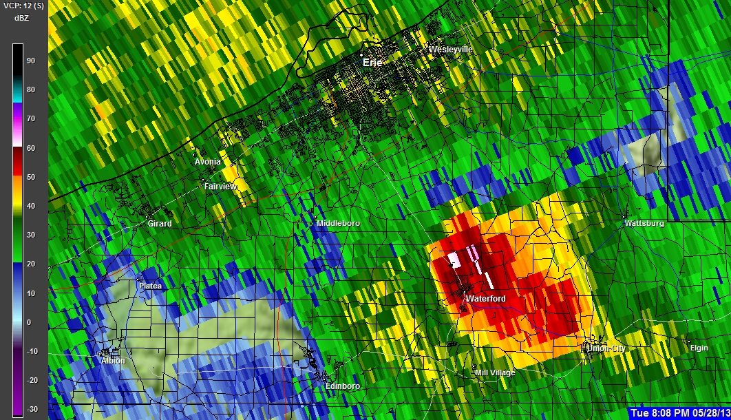
05-28-2013 7:51 PM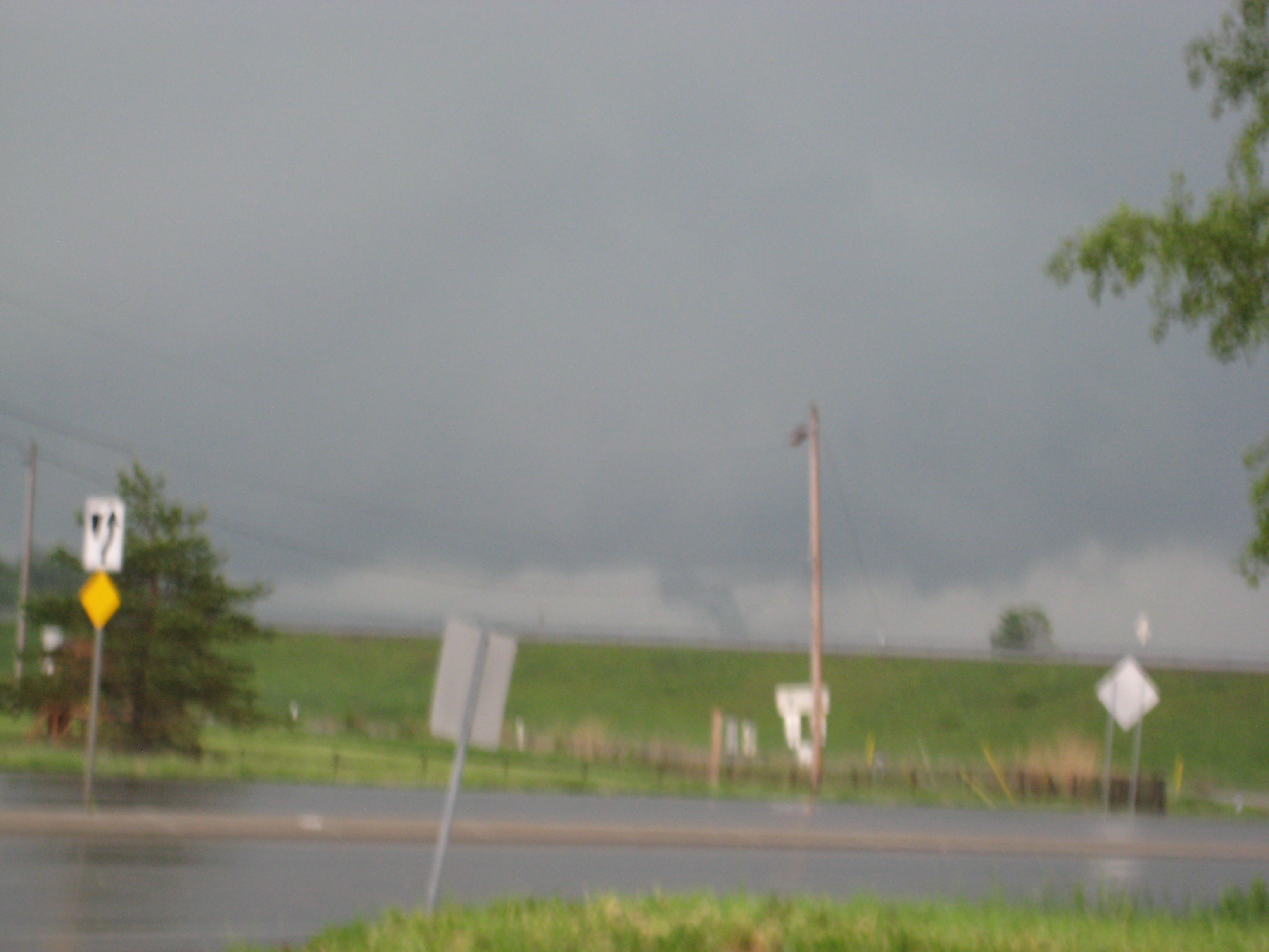
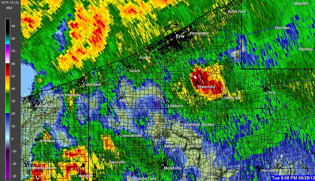
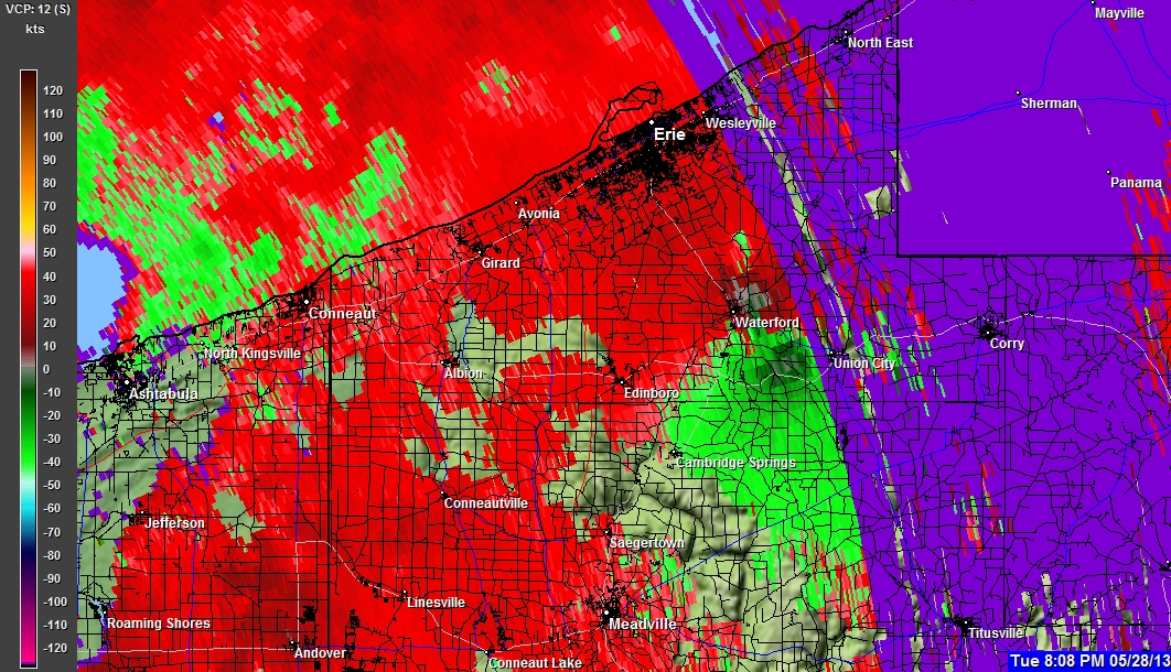
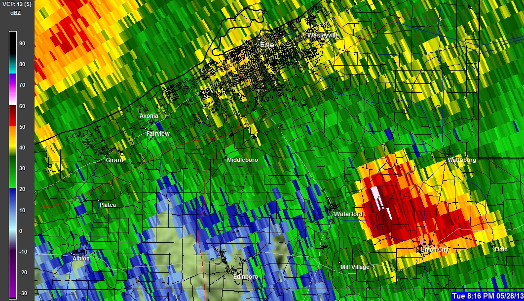
05-28-2013 7:51 PM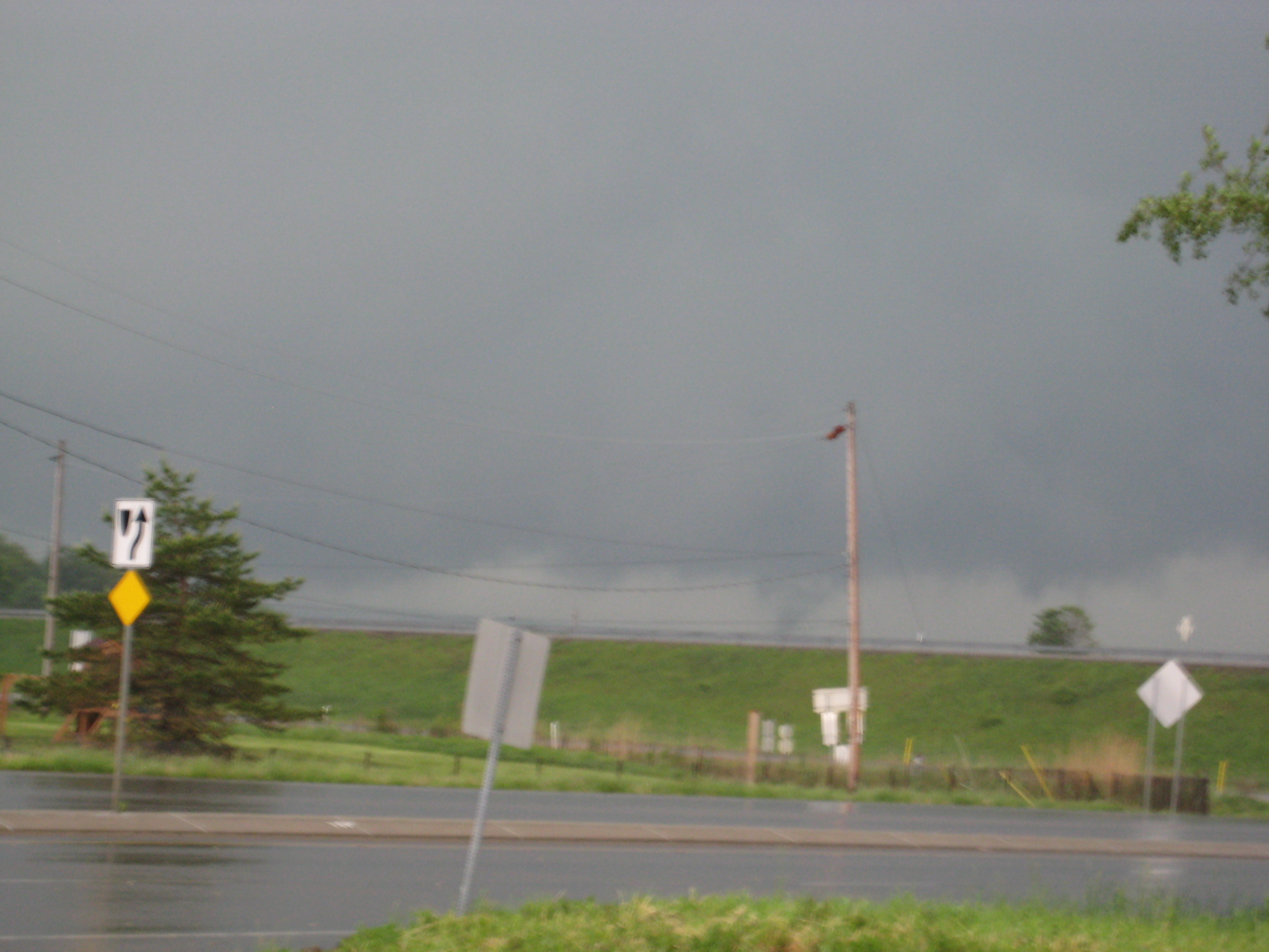
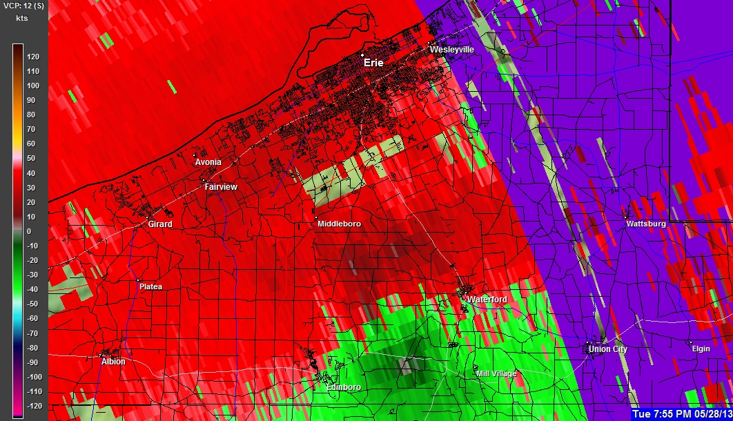
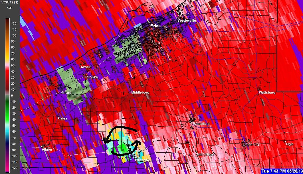
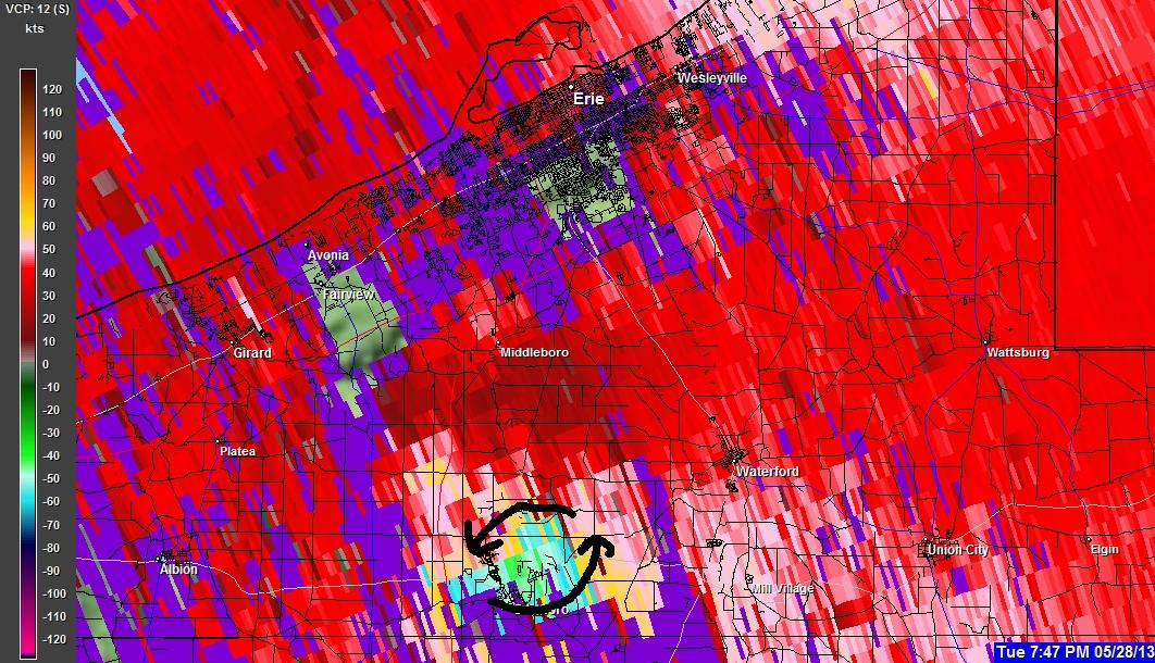
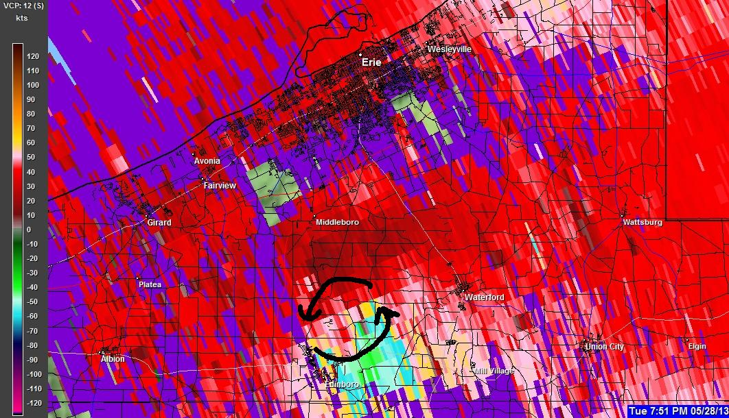
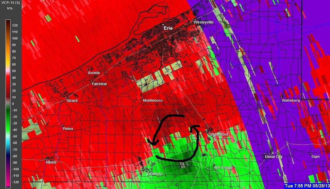
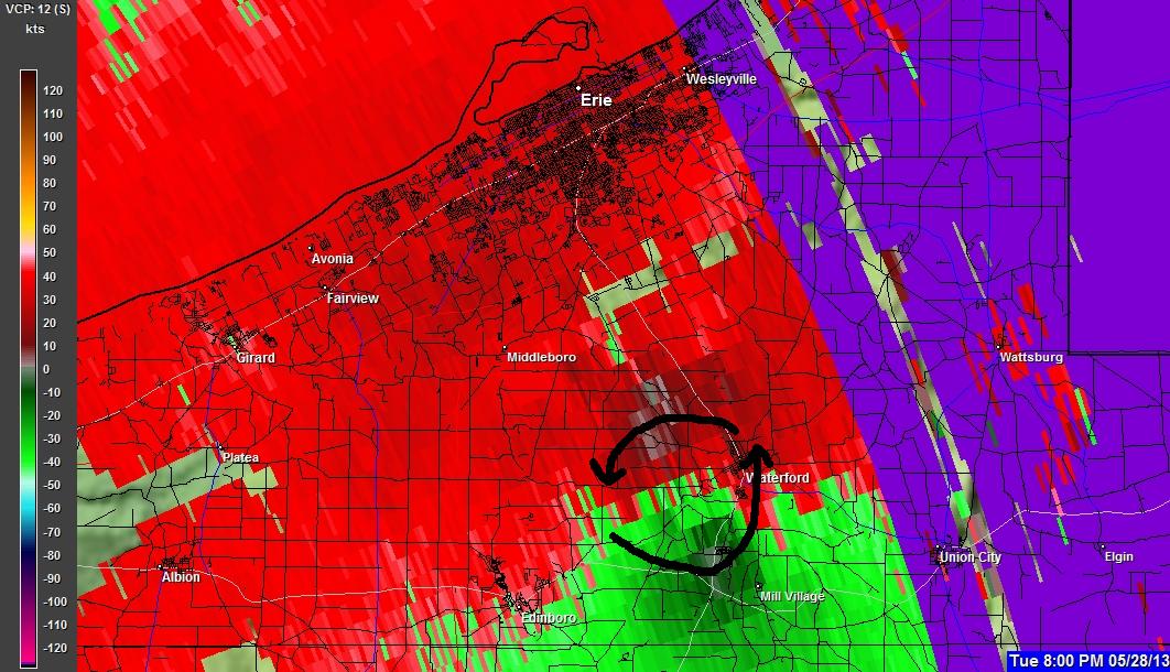
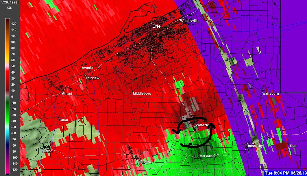
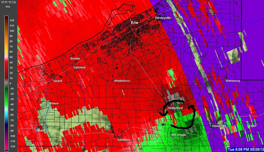
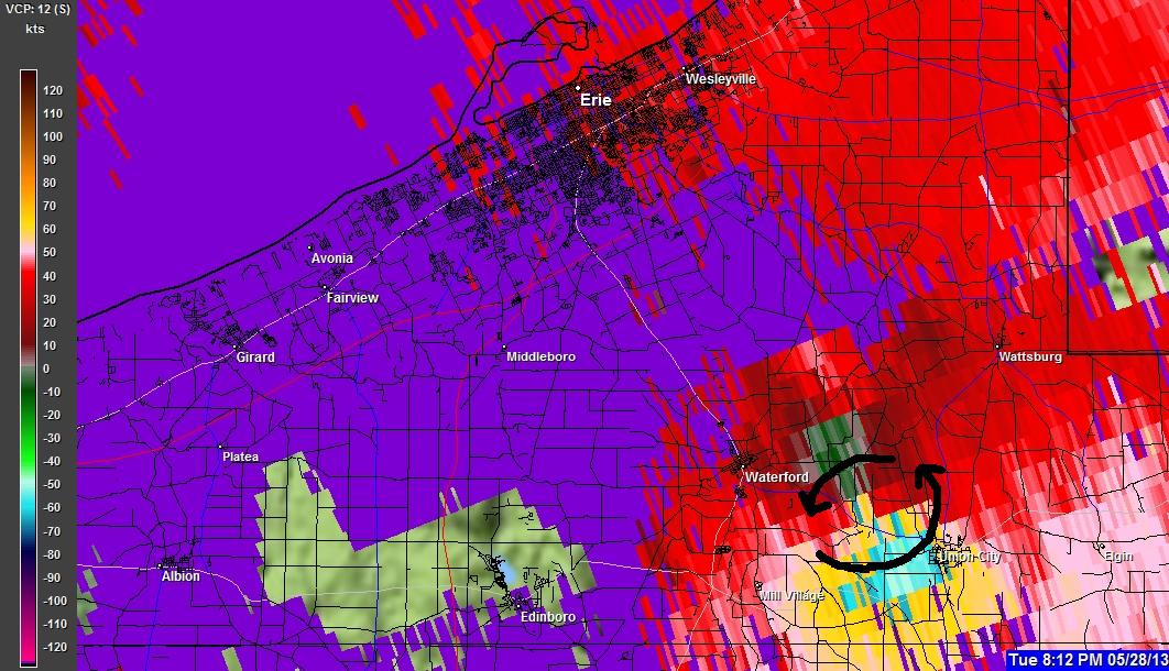
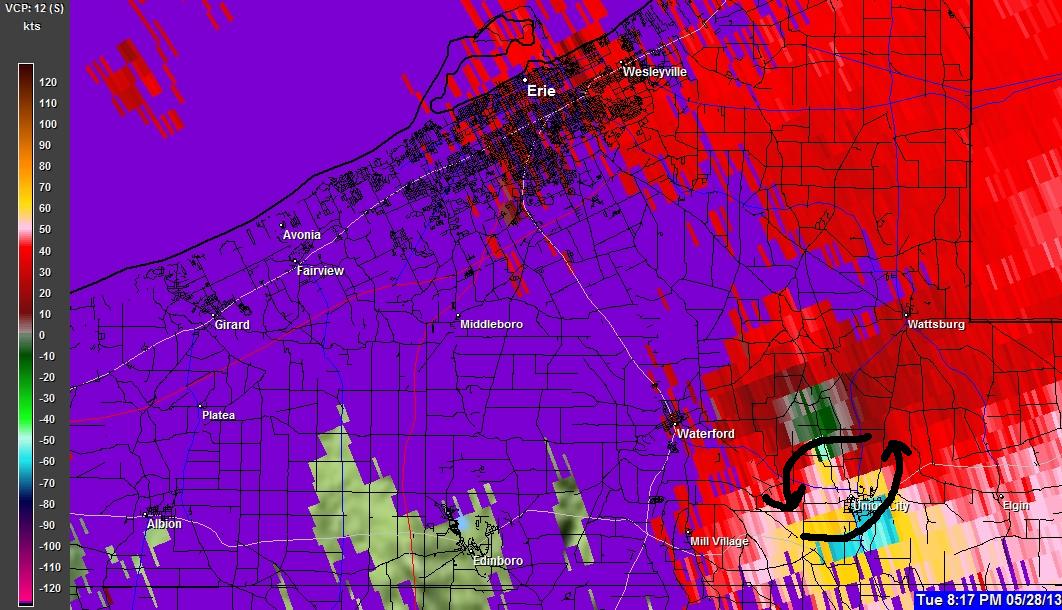
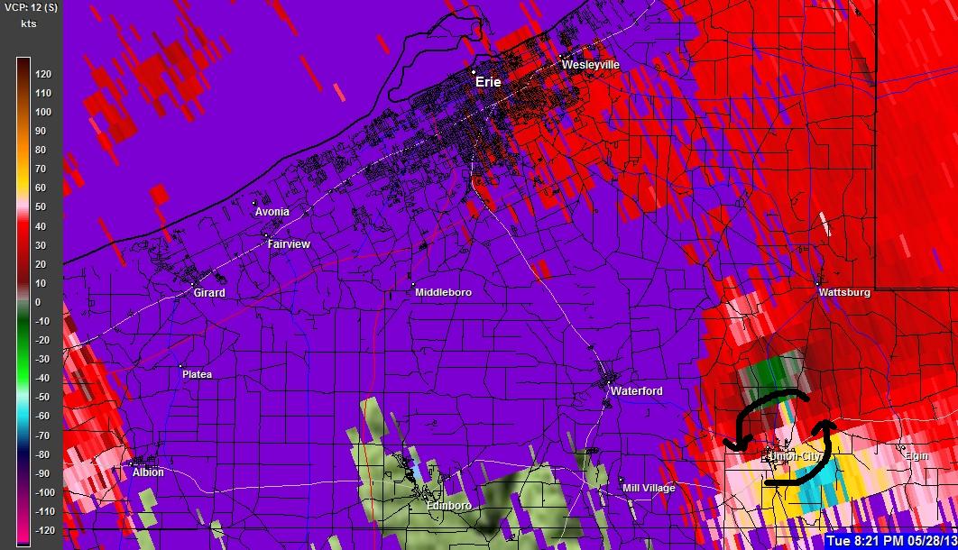
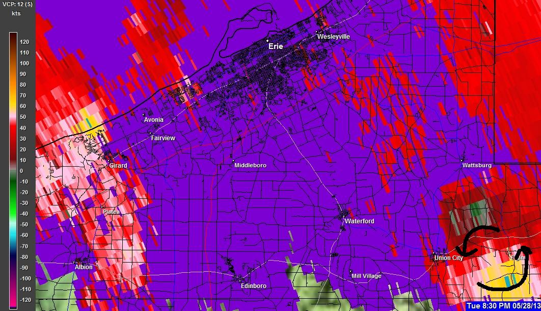
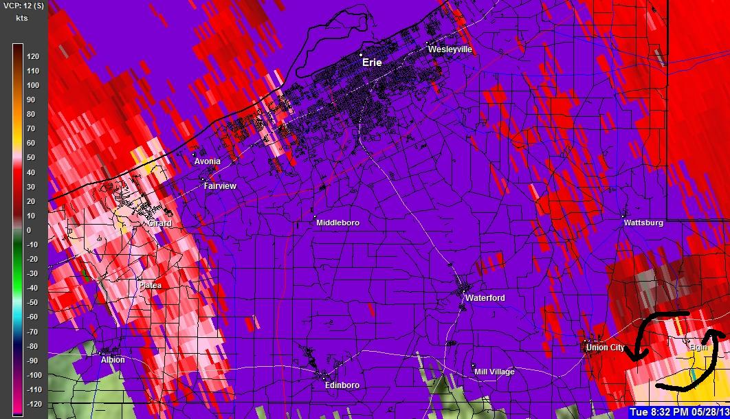
(ZOOMED UP)(ROTATION MARKS INDICATED)


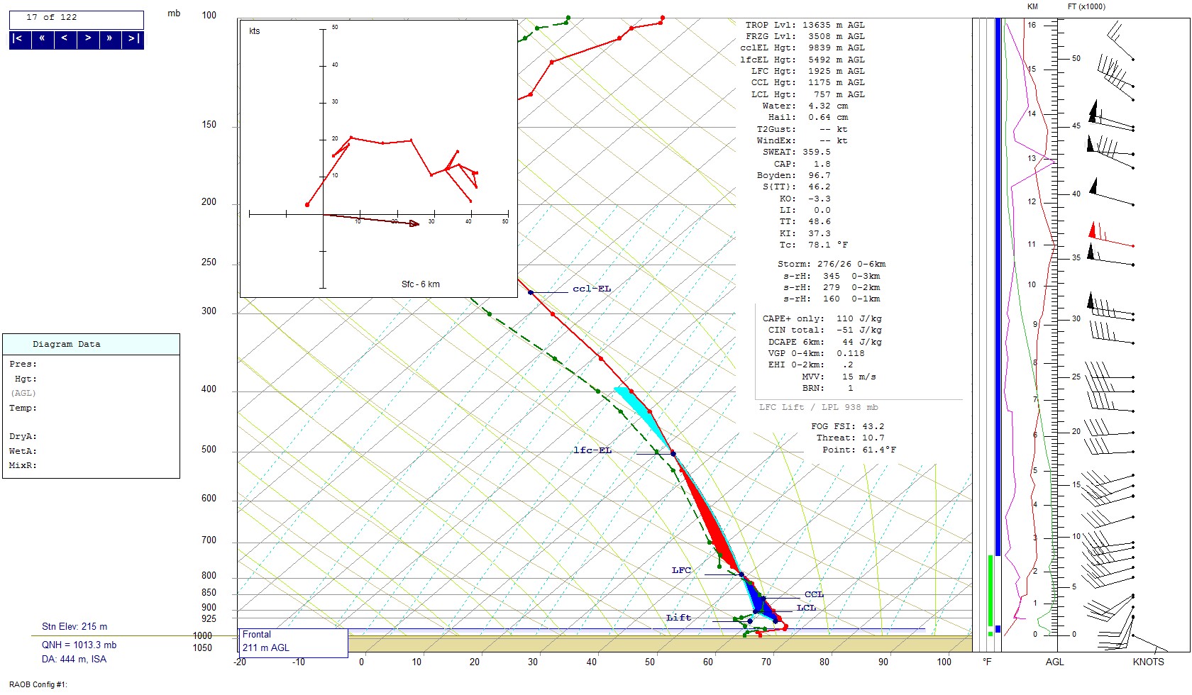
?Upper air sounding (radiosonde) Buffalo, NY 05-28-2013 7:00 PM?
Notice the strong veering (clockwise) winds in the lower 3 km of the atmosphere. Also notice Storm Relative Helicity in the lower 1 km being 160 (m2/s2) and in the lower 3 km being 345 (m2/s2.) These values indicate that there is tight helicity in the lower parts of the atmosphere and any storms that could move streamwise to this, most likely would ingest rotation. This strong wind profile is also supported by the contained hodograph that would suggest rotating updrafts. Also notice the LCL (lifted condensation level) is relativly low (757 meters above ground level) which would promote a warmer rear flank downdraft with more CAPE (Convective available potential energy.)
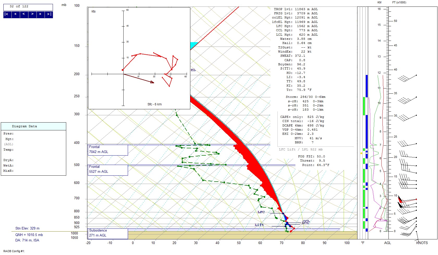
?Upper air sounding (radiosonde) Detroit, MI 05-28-2013 7:00 PM?
As again notice high values of Storm relative Helicity in the lower 1 km being 183 (m2/s2) and in the lower 3 km being 425 (m2/s2.) As indicated in the Buffalo Sounding this one also has a low LCL of 620 meters above ground level.
?Upper air sounding (radiosonde) Pittsburgh, PA 05-28-2013 7:00 PM?
This sounding also has the strong storm relative helicity values of 126 (m2/s2) in the lower 1 km, and in the lower 3 km being 229 (m2/s2.) This sounding also has a relativly strong clockwise signature in the hodograph which would support rotating updrafts. Unlike the previous two soundings there seems to be some dry air in the lower 200 millibars of the atmosphere which is creating a higher LCL of 1296 meters above ground level. On this day Erie County was in the air mass with the lower LCL which would be supportive of Mesocyclone tornadogenesis.
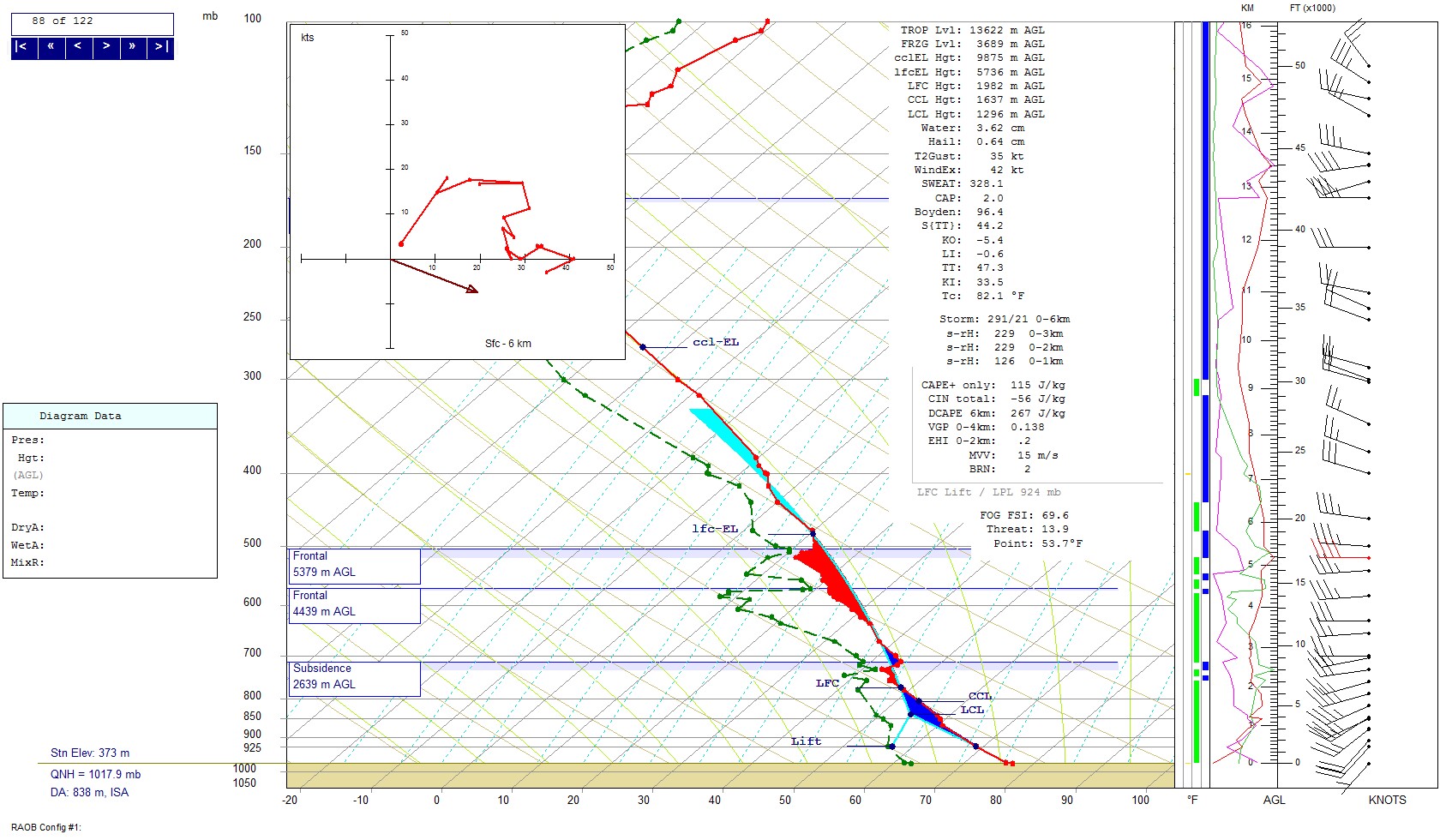
In conclusion, The atmospheric wind profiles were relatively supportive of rotating updrafts, and being that the developing storms were moving parallel in the quasi-stationary front (most likely streamwise) this also aided in the likelihood of the storm updraft ingesting low level helicity.

(ZOOMED UP)?
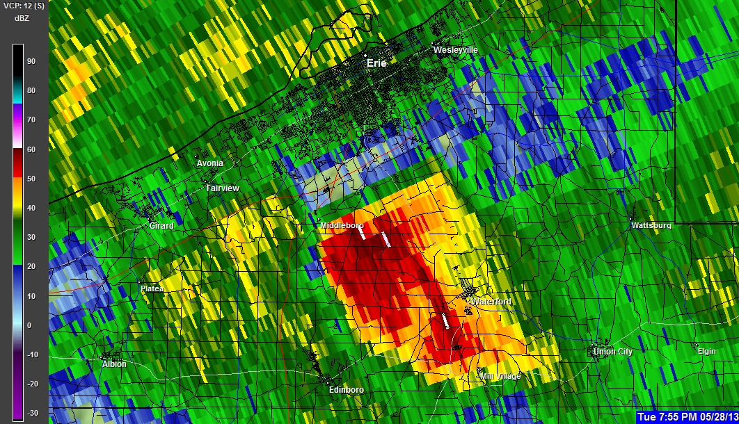

(ZOOMED UP)?